
The Kumano Kodo is one of Japan’s most famous traditional routes. It is located in Japan’s Kii Peninsula mountains. This historic path attracts hikers, nature lovers and travelers from all around the world. Along this route, the visitors can explore ancient places, peaceful forests, traditional villages, and beautiful mountain scenery.
The people who are planning the trip will get a question like how long is the Kumano Kodo trail. The answer to this question depends on which route you choose.
The Kumano Kodo is not just one path. It consists of several routes and each route connects to different places with some difficulty. Some people will spend only one or two days to complete this journey, meanwhile some people will spend nearly one week to complete this journey. It depends on the path you choose.
Table of Contents
- Exploring the Kumano Kodo Routes
- How Long Is the Kumano Kodo Trail on the Popular Nakahechi Route?
- Total Distance of Other Kumano Kodo Routes
- What Fitness level is Kumano kodo?
- Can You Do Kumano Kodo in 3 Days?
- Best time to do Hiking at Kumano Kodo
- Tips for Completing the Kumano Kodo Trail
- Conclusion
- Nakahechi Distances at a Glance
- Planning Notes Before You Go
- How We Would Choose Our Kumano Kodo Length
- Kumano Kodo FAQ
- Sources and Last Check
Exploring the Kumano Kodo Routes
Before saying how long is the Kumano Kodo trail, it is important to understand that the Kumano Kodo is not just one way. There are different paths that people have been using for more than 1,000 years. Understanding the different routes is important when answering the question, “How Long Is the Kumano Kodo Trail?”
The main routes are:
- Nakahechi Route
- Kohechi Route
- Ohechi Route
- Iseji Route
- Omine Okugakemichi Route
Among all these routes the most popular route is the Nakahechi route and it is the most frequently traveled route by the people. This route takes the visitors to three important holy places in Kumano which have beautiful views along the way.
How Long Is the Kumano Kodo Trail on the Popular Nakahechi Route?
When travelers ask how long the Kumano Kodo trail is, they usually mean the Nakahechi route. The classic section from Takijiri-oji to Kumano Hongu Taisha is about 38 to 40 kilometers, and walking on to Kumano Nachi Taisha brings the total to roughly 68 to 70 kilometers, depending on where you start and finish. For most first-time walkers, the Nakahechi is the best choice.
The most popular way to experience Kumano Kodo path in 5 days is:
Day 1: Takijiri-oji to Takahara
The distance will be approximately 4 kilometers. The journey begins at Takijiri-oji, which is the entrance to some sacred places. This is a short path that takes visitors through the beautiful forests and mountain paths before reaching Takahara. It is a small village which has great views and beautiful surroundings.
Day 2: Takahara to Chikatsuyu
The distance is approximately 10 kilometers. The route has beautiful forests with many historic places and peaceful countryside areas. It then reaches a beautiful transitional village called Chikatsuyu.
Day 3: Chikatsuyu to Kumano Hongu Taisha
The distance is roughly 21 to 25 kilometers, depending on your start point and side visits. One of the longest journeys from all the rest 4 days. In this journey the mountain passes through sacred paths and historic places before reaching Kumano Hongu Taisha. Visitors can walk from Chikatsuyu to Kumano Hongu Taisha, but local buses are also available for those who want to reduce the hiking distance or to save time because the distance is so long.
Day 4: Kumano Hongu Taisha to Koguchi
The next hike to Koguchi officially begins at Ukegawa, which is a short bus ride from Hongu. The distance will be approximately 13 kilometers. This route has peaceful forest paths, beautiful mountain way and amazing scenery, having a more relaxed hiking experience. The route gives an opportunity to enjoy the atmosphere of the Kumano region before reaching the small village of Koguchi where the visitors can stay in Koguchi for overnight.
Day 5: Koguchi to Kumano Nachi Taisha
The distance will be approximately 14 kilometers. The final part of the journey is challenging but an unforgettable experience. Visitors will go through the mountain paths before reaching Kumano Nachi Taisha and at the end of the journey, visitors can enjoy the amazing Nachi Waterfall before finishing their Kumano Kodo experience in Kii-Katsuura.

Total Distance of Other Kumano Kodo Routes
Kohechi Route
This Kohechi route was approximately a 70 kilometers distance. It connects Mount Koya with Mount Kumano Hongu Taisha. This route is more challenging compared to other routes, it requires four to six days to complete the journey.
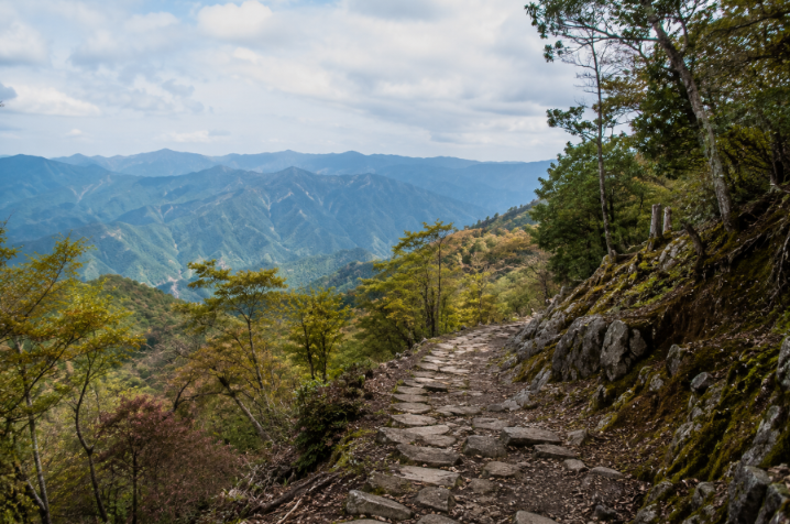
Ohechi Route
The Ohechi Route runs along the southern coast of the Kii Peninsula and the distance will be 120 kilometers. In the past, travelers used this route to enjoy beautiful ocean views on their way to Kumano. But now some parts of the route are not used as hiking paths. It will take 7 to 10 days.
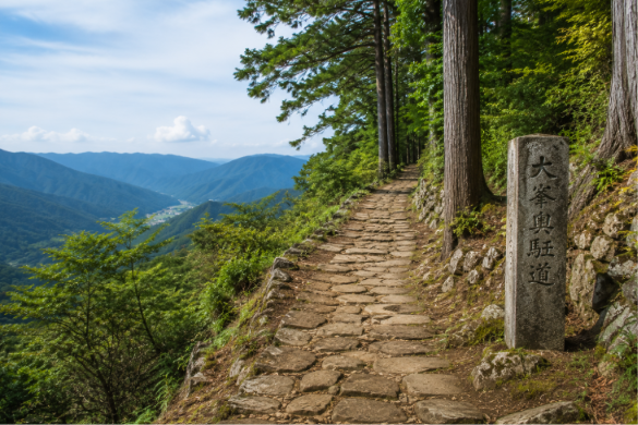
Iseji Route
The Iseji Route is about 170 kilometers distance and connects Ise Grand Shrine with the Kumano area. The visitors need one to two weeks to complete the full route, it depends on the way they choose to travel. It will take 10 to 14 days.
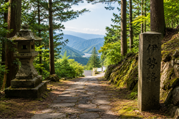
Omine Okugakemichi Route
The Omine Okugakemichi Route is one of the longest and most difficult routes of the Kumano Kodo, the distance is about 170 kilometers through mountain areas. This route is best suited for experienced hikers because it has long distances, steep climbs, and challenging journeys. It will take 7 to 12 days.

What Fitness level is Kumano kodo?
Many travellers often ask, “What fitness level is required for Kumano Kodo?”. Most people with basic fitness can enjoy the Nakahechi Route. There is no need to be a professional hiker or athlete, everyone with basic fitness can go for trekking.
But the people should be prepared for walking daily about 10 to 25 kilometers. Some parts of the route will have uphill and downhill walks. The paths can be uneven, with rocks and tree roots along the way. The weather can be hot and humid during certain times of the year.
If you can walk for a few hours and manage to climb some hills, you can complete most Kumano Kodo routes. Doing regular walks for a few weeks before your trip can help make the journey easier, comfortable and more enjoyable.
Can You Do Kumano Kodo in 3 Days?
Another frequently asked question is “Can you do Kumano Kodo in 3 Days?” Yes, many travellers complete the journey in 3 days through the Nakahechi Route.
The three days are:
Day 1. Takijiri-oji to Chikatsuyu
Day 2: Chikatsuyu to Kumano Hongu Taisha
Day 3: Explore Hongu and travel onward
Through these three days maximum places can be covered but to experience the complete beauty of the journey it is better to spend four to five days so the complete beauty of the Kumano Kodo path will be experienced.
Best time to do Hiking at Kumano Kodo
If you are wondering how long is the Kumano Kodo Trail and when to hike it, autumn offers some of the best conditions for the journey. Autumn is mostly preferred as the best time to hike the Kumano Kodo. The weather is cool and comfortable, the humidity levels will be low, and the forests are filled with beautiful colors. These things will make hiking more enjoyable and comfortable. The sky will be clear and pleasant.
Other seasons can also be considered. During the spring season there will be beautiful cherry blossoms so the view will be more beautiful. In the summer season the weather will be hot and humid but due to the forests the heat will be reduced but compared to other seasons this is not mostly preferred. And finally in winter the crowd will be less this time and the temperature will be cool so even this season can be considered to visit.
Tips for Completing the Kumano Kodo Trail
To make this trip comfortable and to have the best experience. Walk daily before visiting to make it easier. Pack fewer items for hiking so it will be easier to carry. Wear proper shoes for hiking so it will be comfortable, carry sufficient water to stay hydrated and finally book your tickets early.
Conclusion
So, “How long is the Kumano Kodo Trail?” The answer to this question depends on the route you choose. The most popular route, Nakahechi will be 65 to 70 kilometers and it takes three to five days to complete the journey. Longer routes such as the Iseji and Omine Okugakemichi can be nearly 170 kilometers and will take more than a week to complete the journey.
For most travelers, the Nakahechi Route will be the perfect route to visit all the ancient things in between. Whether you spend three days or two weeks travelling along this path, this experience will be unique by visiting its ancient places, and to feel the spirituality, culture, and natural beauty.
Nakahechi Distances at a Glance
The table below collects distances and walking times from published itineraries, so you can check the day lengths above. Figures are approximate and vary with where you start and which side trails you add.
| Section | Distance | Typical walking time | Source |
|---|---|---|---|
| Takijiri-oji to Takahara | About 4 km | 2–3 hours | Self Guide Japan |
| Takahara to Chikatsuyu | About 9–10 km | Half a day | JTB itinerary |
| Takijiri-oji to Chikatsuyu | About 13 km | About 5 hours | JapanTravel |
| Chikatsuyu to Kumano Hongu Taisha | About 25 km | About 7.5 hours | JapanTravel |
| Takijiri-oji to Kumano Hongu Taisha (total) | About 38–40 km | 2–3 days | Inside Kyoto |
| Koguchi to Kumano Nachi Taisha | About 14 km | About 7 hours | RAW Travel itinerary |
| Takijiri-oji through to Nachi (total) | Roughly 68 km | 4–6 walking days | Self Guide Japan |
Planning Notes Before You Go
- Gateway: Kii-Tanabe is the usual starting town. Osaka to Kii-Tanabe by train takes a little over two hours, and a local bus from the station to Takijiri-oji takes about 40 minutes.
- Lodging is the bottleneck: the villages along the trail have limited rooms. The Tanabe City Kumano Tourism Bureau runs a reservation system for lodging, luggage transfers and activities, and it is wise to book early.
- It is the easier Kumano route, not an easy walk: the Nakahechi is described as the easiest of the Kumano Kodo trails, but it still climbs and descends through mountains, so plan proper footwear and food.
- Check the day you will be on the trail: bus timetables and lodging availability change with the season.
How We Would Choose Our Kumano Kodo Length
| Time you have | What we would do | Stats in this guide |
|---|---|---|
| 3 days | Takijiri-oji to Chikatsuyu, then Chikatsuyu to Kumano Hongu Taisha, then explore Hongu | About 38–40 km to Hongu |
| 4 to 6 walking days | Continue via Koguchi to Kumano Nachi Taisha | Roughly 68 km in total |
| A week or more | One of the longer routes, such as the Kohechi, Ohechi, Iseji or Omine Okugakemichi | Roughly 70 to 170 km |
If we had only a long weekend, we would take the three-day Nakahechi version and use the local bus on the long Chikatsuyu to Hongu stretch, which this guide says is possible when 21 to 25 km is too much. We would book lodging first, since villages along the trail have few rooms and the Tanabe City Kumano Tourism Bureau runs a reservation system, and we would keep the last day, Koguchi to Nachi, for when we could give it a full 7 hours.
For the trail comparison, see our Nakasendo vs Kumano Kodo guide, for the pilgrimage context our Kumano Kodo pilgrimage guide, and for the nearby Omine range, Odaigahara and Omine.
Kumano Kodo FAQ
How long is the Nakahechi route?
About 38 to 40 km from Takijiri-oji to Kumano Hongu Taisha, or roughly 68 km if you continue to Kumano Nachi Taisha. Most walkers take two to three days to reach Hongu and four to six days to reach Nachi.
How many hours a day do I walk?
Published itineraries range from about 2 to 3 hours on the short first day to 7 to 9 hours on the longest day between Chikatsuyu and Hongu.
Which Kumano Kodo route is easiest?
The Nakahechi is considered the easiest of the trails, and it is also the best known.
Sources and Last Check
We compiled the figures above from published itineraries and guides, not from a first-hand walk. We last checked them on October 9, 2026, but trail conditions and timetables change. Confirm the latest information with the Tanabe City Kumano Tourism Bureau before you travel.
