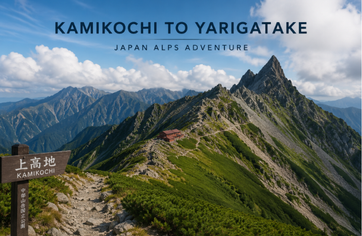
The hike from Kamikochi to Yarigatake is one of the most popular hikes in the Northern Japan Alps which covers around 35 to 40 km and also includes the 22 km from Kamikochi to the summit of Mount Yarigatake (槍ヶ岳). This journey climbs around 2,100 meters through some of the most beautiful scenery in the Northern Japan Alps.
The journey begins in the peaceful Kamikochi Valley at 1,500 meters above sea level. Along the way you will see some beautiful places such as Myojin, Tokusawa, Yokoo and the Karasawa area before making the final steep climb to the 3,180 meter summit of Mount Yarigatake (槍ヶ岳).
From the top of the mountain people can view some nearby peaks like Mount Okuhotaka (奥穂高岳), Mount Kitahotaka (北穂高岳), Mount Karasawa (涸沢岳) and the Hotakadake (穂高岳) mountain range. Most hikers will complete the journey in 3 or 4 days by staying in mountain huts.
Planning before starting your trip is important. You need to take a bus to Kamikochi. Also you should book mountain huts in advance and bring the right hiking gear especially if you are visiting outside the main hiking season. Mountain huts and water sources are available around every 10 to 15 km to make it easy to divide the trek into simple stages.
The best time to go hiking is from July to September. This is the time when the trails are free of snow. Even during summer the afternoon thunderstorms are common.
From this guide you will understand everything including the daily itinerary, transportation, mountain huts and safety tips.
Table of Contents
Day 1: Kamikochi to Yarisawa Lodge (4–6 Hours)
The hike starts at Kamikochi Bus Terminal which is 1,500 meters above sea level. From here we go to the famous Kappa Bridge and follow the trail along the clear Azusa River.
The first part of the hike is mostly comfortable, winding through beautiful forests and scenic areas toward Tokusawa. After 3 to 4 hours we will reach Yokoo, which is around 1,620 m, where several hiking routes meet. It is a good place to stop for lunch and take a short break before continuing.
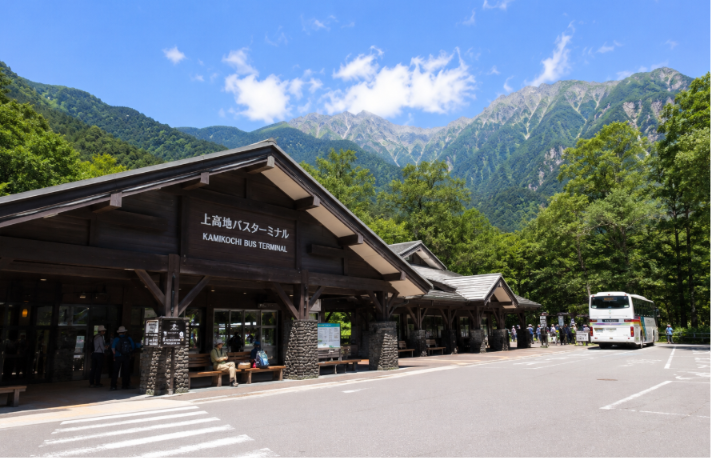
Kamikochi bus terminal
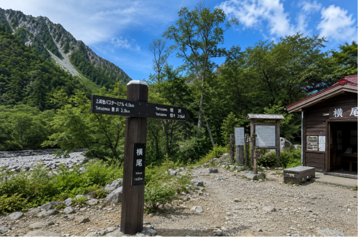
Hikers take a well-earned break at Yokoo before continuing their journey
After Yokoo the path becomes a little steeper but the beautiful scenery will make the climb enjoyable. We then go to Baba-daira, a campsite at around 1,800 meters, before walking a short distance to Yarisawa Lodge (1,820 m).
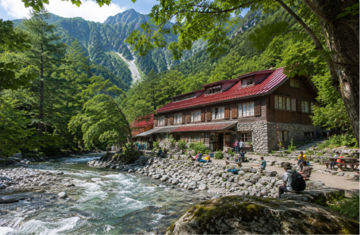
Yarisawa Lodge is a beautiful stone mountain hut beside the river. It has comfortable facilities, including a bath and flush toilets, which make it a great place to rest after the first day. The first day of hiking covers about 11 to 12 km with around 1,300 meters of elevation gain. After arriving, enjoy dinner and relax.
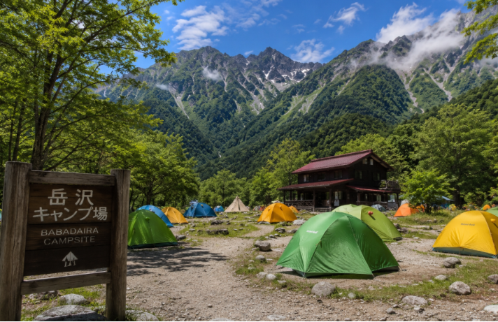
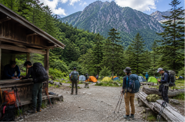
Baba-daira campsite
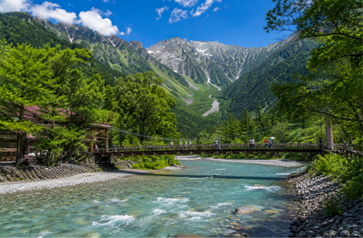
Kamikochi’s iconic Kappa Bridge spans the milky Azusa River with the Hotaka peaks beyond
Day 2: Yarisawa Lodge to Yarigatake Sanso Hut (8–9 Hours)
We start our second day before sunrise and begin hiking through the beautiful Yarisawa Valley. After 2 hours of hiking we will reach Tengu Pond, which is 2,300 m. If the weather is clear, the water reflects Mount Yarigatake, creating a beautiful view that many hikers stop to take pictures.
From Tengu Pond the journey becomes a little difficult. We follow a series of switchbacks as we climb towards Tenguhara Col (2,348 m). We walk through open grassy fields around Baba-daira and enjoy amazing views of the mountains around us.
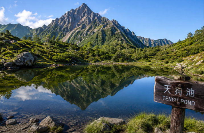
Tengu Pond
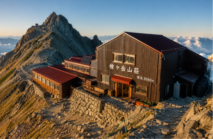
Yarigatake Sanso Hut, a great place to relax
The final stretch to Yarigatake Sanso Hut at 3,080 m is the hardest part of the day. This path is very steep, with fixed chains to help hikers climb safely to the hut. We usually arrive in the afternoon after 8 to 9 hours of hiking.
Along the way you can see beautiful old trees near Tenguhara and enjoy stunning views of the Hotaka Range as you continue climbing. If you prefer a shorter day, camping is also possible at Tenguhara or nearby campsites.
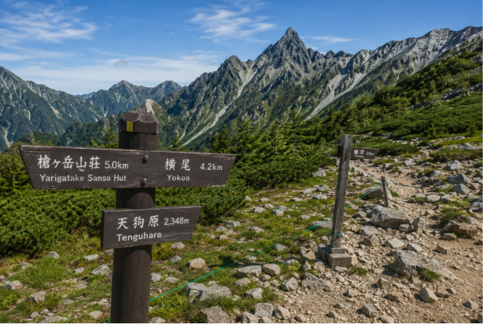
Camping at Tenguhara is possible with permission
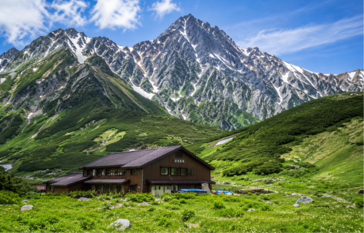
An alpine hut nestling in a mountain meadow beneath snow-speckled peaks.
Day 3: Yarigatake Hut to the Summit and Back to Kamikochi (6–8 Hours)
We start the day before sunrise, usually around 5:00 AM, for the final climb to the top of Mount Yarigatake (槍ヶ岳). The climb takes about 30 minutes over a rocky path, with some snow patches depending on the season.
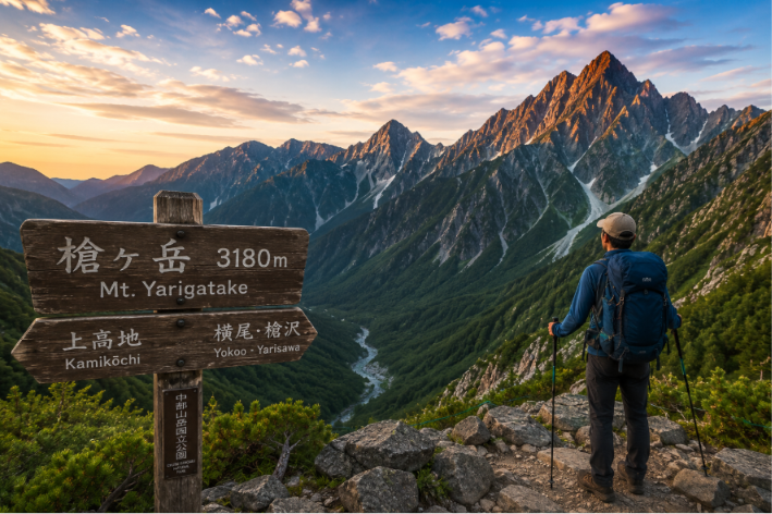
When we reach the top of the mountain at 3,179 meters, we can see the amazing 360-degree views. On a clear day you can see Mount Hotaka (穂高岳), Mount Norikura (乗鞍岳) and the beautiful Yari mountain ridges.
After spending some time at the top of the mountain we return to Yarigatake Hut for breakfast. Then we begin our long hike back into the valley. The journey takes us through places like Tenguhara, Baba-daira and Yokoo where we walk through peaceful forests and beautiful mountain paths.
We reach Tokusawa (1,560 m), a great place to stop for lunch and take a short rest. After that we follow the easy trail along the Azusa River back to Kamikochi. The walk from Yokoo to Kamikochi takes about 3 to 4 hours.
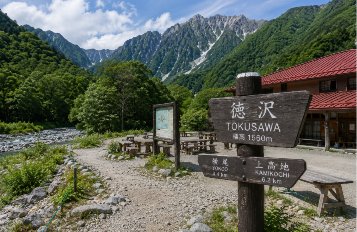
Tokusawa
This Day 3 hike includes only about 100 meters of climbing but around 1,520 meters of descent, so it can still be tiring. We usually arrive back in Kamikochi by afternoon, which makes it an unforgettable mountain adventure.
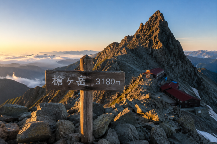
Mount Yarigatake
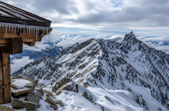
View from Yari summit
Day 4: Depart from Kamikochi
On the last day you can leave Kamikochi. If you have some extra time, take a peaceful morning walk around Taisho Pond or Hotaka Pond and enjoy the beautiful mountain scenery one last time. It is a relaxing way to end your hiking trip before taking the bus back.
Transport & Permits
You cannot drive your own car into Kamikochi because private cars are not allowed. If you come by car, park it at Sawando (Nagano side) or Hirayu (Gifu side). From there take a bus or taxi to Kamikochi Bus Terminal. The journey takes about 20 to 30 minutes and the cost is around ¥2,000 to ¥5,300 depending on your starting point.
If you are travelling from Tokyo, one of the fastest options is to take the Hokuriku Shinkansen to Nagano, which takes about 92 minutes. From Nagano you can catch the Alpico Express Bus to Kamikochi, which takes around 105 minutes.
Related Information: Do You Need a Permit to Hike in Japan?
During the summer season you can also take direct highway buses from Shinjuku, a journey of about 5 to 6 hours, or from Nagoya, which takes around 3 hours.
You do not need special permission to hike from Kamikochi to Mount Yarigatake. It is necessary to carry a photo ID and your hiking plan for extra safety. Many hikers also submit a Tozan Todoke (登山届), a hiking registration form used in Japan.
At Myojin Pond and Hotaka Shrine you may be asked to pay a small Nature Conservation Fee (自然保護協力金), which is around ¥300. Other than this small amount, no park entry pass or additional permissions are required for hiking in the Northern Japan Alps.
Accommodation & Booking
There are two main mountain huts on the Kamikochi to Yarigatake route where most hikers stay overnight.
Yarisawa Lodge (槍沢ロッヂ, 1,820 m)
Yarisawa Lodge is a large mountain hut beside the Azusa River and it is surrounded by beautiful forests. Inside there are shared rooms if you come alone or as a pair, and a few private rooms, but you need to book the private rooms in advance. The hut also serves hot meals after a long day of hiking.
You will also find useful facilities like showers, baths and flush toilets. If you plan to camp at the nearby Baba-daira Campground you need to register at the Yarisawa Lodge.
Yarigatake Sanso (槍ヶ岳山荘, 3,080 m)
Yarigatake Sanso is a famous mountain hut located just below the top of Mount Yarigatake. It has shared rooms and private rooms, but it is best to book early because it fills up quickly during the hiking season.
The hut provides meals, places to sit and rest and free drinking water collected from filtered rainwater. If you want to camp nearby, the staff at the mountain hut will show you where to set up your tent.
Booking Information
Both mountain huts are usually open from April or May until October. The exact opening dates may change each year so it is better to check the official website before your trip.
It is important to book your mountain hut early, especially during the busy summer season. Online bookings usually open one month in advance, and you can also book by phone.
A one-night stay with dinner and breakfast usually costs around ¥16,000 per person. If you want to camp, the campsite fee is about ¥2,000 per person per night. Students and young hikers may receive special discounts.
Camping is allowed only at official campsites. Popular camping areas on this route include Baba-daira Campground, Tokusawa Campground and Yokoo Campground.
You do not need a camping permit, but you must register when you arrive at the campsite. Campfires are not allowed, so you should use a camping stove for cooking.
