
Mount Tsurugi is one of the most famous mountains in Tokushima Prefecture. Its height is 1,955 m and it is known for its beautiful views and peaceful nature. Additionally, Mount Tsurugi is one of Japan’s 100 Famous Mountains.
This guide covers Mount Tsurugi (Ken-zan) in Tokushima Prefecture, a gentle hike with a chairlift. It is not to be confused with Tsurugi-dake (2,999 m) in Toyama Prefecture, a serious Northern Alps climb that is a different mountain entirely.
One of the best things about Mount Tsurugi is that you do not have to walk all the way from the bottom. From April to November, you can take a chairlift for about 15 to 20 minutes. Moreover, the chairlift takes you to Nishijima Station at 1,750 m.
From there it takes around 1 hour to walk to the top of the mountain. Because of this, many beginners and families choose the Mount Tsurugi hike as the trail is relatively easy to complete.
Once you reach the top, you will find a peaceful resting area with beautiful scenery. On a clear day, you can enjoy amazing views of the Seto Inland Sea, the Pacific Ocean and even Honshu.
Table of Contents

Chairlift to Nishijima Station
From Nishijima Station you will find three marked hiking routes that lead to the top of the mountain. Therefore, you can choose the path that feels best for you and matches your time and hiking experience.
Ridgeline Route
The Ridgeline Route is the shortest and easiest way to reach the top of the mountain. It is about 0.9 km long and takes around 40 minutes. On this journey you go along the mountain ridge, which has well maintained paths and steps. It is safe and suitable for beginners and families. As you go higher, you can enjoy beautiful views of the surrounding mountains. Moreover, the trail is clearly marked, which makes it easy to follow.
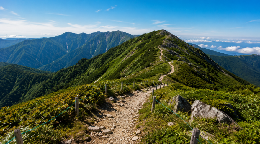
Beauty on the ridgeline walk
Otsurugi Shrine Route
The Otsurugi Shrine Route is about 1.2 km long and takes around 1 hour. Along the way you will pass the Otsurugi shrine, a small site on the mountain. Near the shrine there is a famous natural spring called Goshinmizu, known for its clear water. This path is easy to walk and is a good choice if you want to see the traditional places during your hike.
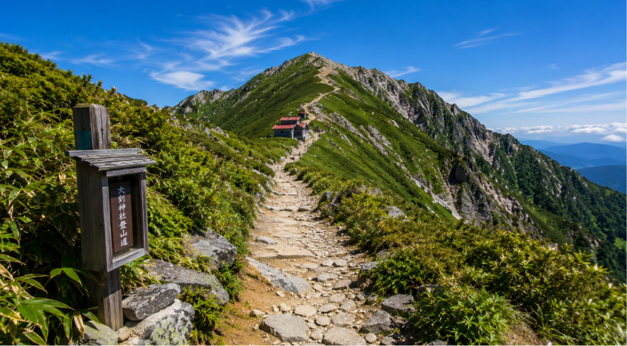
Amazing views of Otsurugi Shrine Route
Walking Trail
The Walking Trail is the longest route to the summit. It is about 2 km long and takes around 1 hour 20 minutes. This route passes through forests and open mountain areas which give you plenty of beautiful scenery along the way. It also passes the Nidomi Observatory, a viewpoint where you can enjoy great mountain views.
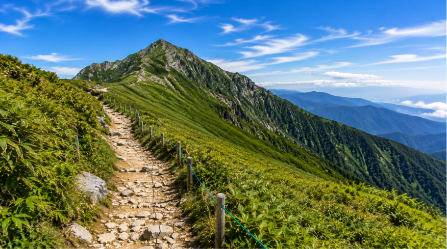
View from the walking trail
Gear and Preparation
Before starting your Mount Tsurugi hike, make sure you carry the right items with you. Also, wear comfortable clothes that you can add or remove as the weather changes. Even in summer it can feel cold at the top of the mountain, so bring a warm jacket and a waterproof rain jacket too.
Wear hiking shoes with good grip because some parts of the trail are rocky and uneven so good shoes will help you. Carry 1.5 to 2 liters of water, some snacks, a hat, sunscreen and sunglasses. If you are hiking early in the morning or returning late, don’t forget to bring a headlamp or flashlight.
Every route is well marked with signboards, but it is still a good idea to carry a route map or use a GPS device. In some areas phone signals may not work, so do not depend only on your phone for directions; carry a proper map instead.
Before you start your hike, let someone know where you are going. If the weather changes, it is better if someone knows your route. Having travel insurance that covers hiking and mountain rescue is also a good idea for a safe trip.
Before your trip, learn more about: Do You Need a Permit to Hike in Japan?
When Is the Best Time to Climb Tsurugi?
Spring, from April to May, is a great time to visit Mount Tsurugi. The chairlift starts in April and the mountain becomes green with fresh plants and flowers. There may still be some snow near the top of the mountain, so check the weather before your trip.
Summer, from June to August, has pleasant weather for hiking. Some days may be rainy or foggy, so carry a rain jacket. This is also the busiest season, so it is best to arrive early. During July and August you can also see beautiful yellow flowers along the way.
Autumn, from September to November, is one of the best times to hike. The weather is cool and the mountain is covered with colorful red, orange and yellow leaves. The chairlift will be closed in late November depending on the weather.
Winter, from December to March, is not a good time for most hikers. Heavy snow covers the mountain, the roads may be closed and the chairlift does not operate. Hiking in winter is only suitable for experienced climbers with special snow gear.
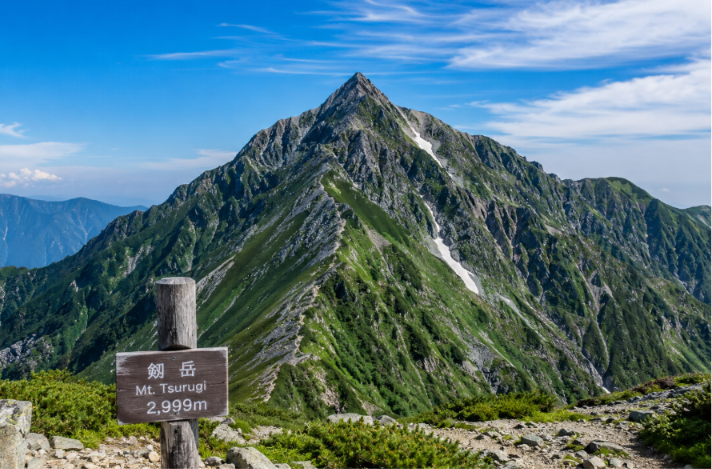
Beautiful view of Mount Tsurugi
Tsurugi’s Sacred Mountain Heritage
Mount Tsurugi (1,955 m) is a sacred mountain as well as a popular hiking peak. Its name means “sword”, and local legend says that Emperor Antoku of the Heike clan hid a sword in the mountain. The Heike are also said to have taken refuge in the nearby Iya Valley after losing the Genpei War, which is why stories of the clan are told across the region.
The mountain is also an important centre of Shugendo, a mountain-worship tradition that blends Shinto and Buddhist practice, and you may pass places once used for ascetic training on the way up. Until the early Showa period the mountain was closed to women. Otsurugi Shrine, described in the Otsurugi Shrine Route section above, is the most visible sign of this tradition on the way to the summit.
How to Get to Mount Tsurugi
Most hikers start from the Minokoshi trailhead on the Iya Valley side of Tokushima Prefecture, and a rental car is the easiest way to get there. By public transport, take a train to Awa-Ikeda Station (or Oboke Station), a bus to Kubo, and then a local bus to Minokoshi, the last stop near the lower chairlift station. From the Tokushima side, a direct climbing bus also runs from JR Sadamitsu Station to Minokoshi.
Bus services to Minokoshi are seasonal and limited. They do not run in winter, they run daily only on peak dates such as the summer holidays and the autumn colour season, and otherwise they run on weekends and public holidays from spring to late autumn, with only a few services a day. Check the latest timetable on the Tokushima Prefecture or Miyoshi City website before you travel. From Minokoshi the chairlift to Nishijima Station takes about 15 minutes. If you prefer to walk the whole way, the climb from Minokoshi takes around two hours. The mountain sits at the eastern end of the Iya Valley, so many visitors combine the hike with the valley’s vine bridges and hot springs.
How We Would Plan a Tsurugi Day
| Route from Nishijima Station | Stats in this guide | What stands out |
|---|---|---|
| Ridgeline Route | About 0.9 km, around 40 minutes | The shortest and easiest, with maintained paths and steps |
| Otsurugi Shrine Route | About 1.2 km, around 1 hour | Passes Otsurugi Shrine and the Goshinmizu spring |
| Walking Trail | About 2 km, around 1 hour 20 minutes | The longest, through forest and open ground, past the Nidomi Observatory |
Because all three routes start at Nishijima Station, we would go up one way and come down another, for example up the Otsurugi Shrine Route for the sacred heritage and down the Ridgeline for speed. The more important decision is logistics. This guide says buses to Minokoshi are seasonal and limited, with only a few services a day outside peak dates, so we would plan the day around the last bus, not around the summit, and check the Tokushima Prefecture or Miyoshi City timetable before travelling.
We would aim for autumn, when the guide describes the mountain in red, orange and yellow, and keep in mind that the chairlift runs from April and closes in late November depending on the weather. Pack a warm jacket even in summer, since the top feels cold. For Shikoku’s other big climb, see our Mount Ishizuchi guide, and for paperwork questions, our guide on hiking permits in Japan.
Final Summary
Mount Tsurugi is 1,955 meters high and it is one of the highest mountains in western Japan. Most hikers start from Nishijima Station. From there you can see three marked trails which lead to the top of the mountain. The hike takes about 40 to 80 minutes, depending mostly on the route you choose. From April to November you can also use the chairlift to make the climb easier.
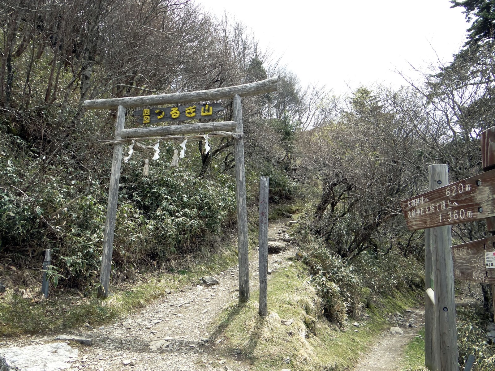
Wooden torii marking a trail entrance on Ken-zan. Photo: Rémi Borny, CC BY 4.0, via Wikimedia Commons
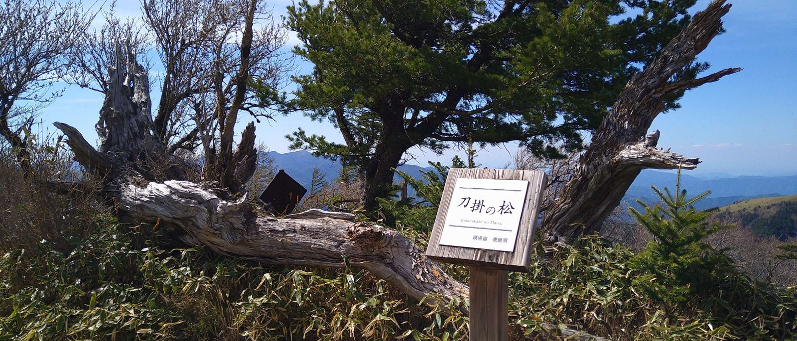
Katanakake-no-Matsu, the famous sword-resting pine on the trail to Ken-zan’s summit. Photo: Araiyasushige, CC0, via Wikimedia Commons
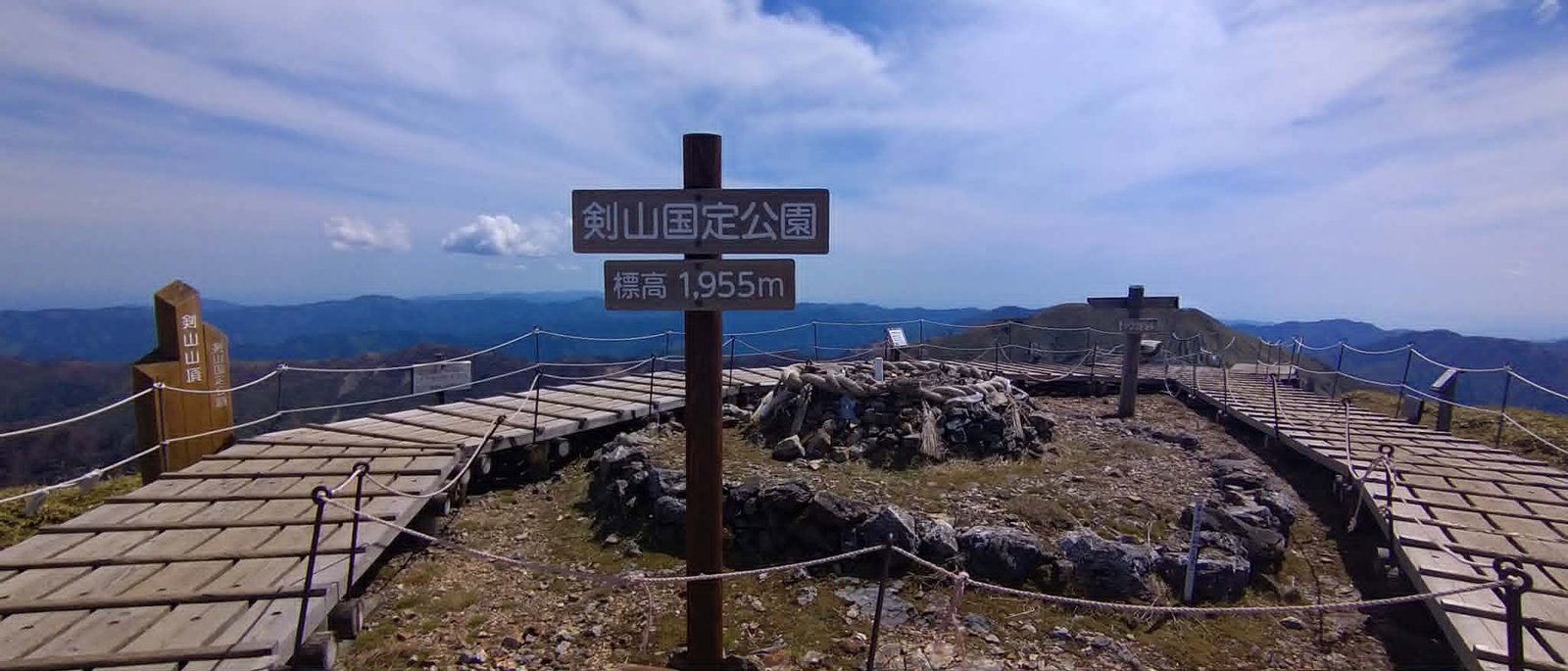
The summit of Ken-zan (1,955 m), with the park signpost, wooden boardwalk and sacred rock wrapped in shimenawa rope. Photo: Araiyasushige, CC0, via Wikimedia Commons
The hike is easy to moderate. It is a good choice for beginners and families. Spring brings fresh flowers, summer gives cool mountain weather and autumn is famous for its colorful leaves. Winter is not a good time for most visitors because there will be heavy snow and some roads are closed.
There is no permit needed to hike Mount Tsurugi. If you want to stay overnight, there is a campground near Nishijima Station. It is also a good idea to have travel insurance that covers mountain hiking.
A hike to Mount Tsurugi is a wonderful way to enjoy nature, fresh mountain air and beautiful views. Even if it is your first time hiking, or you have hiked many mountains before, Mount Tsurugi is still a great place to explore and create memories.
You may also like to know about: How Hard Is It to Climb Mount Fuji?
