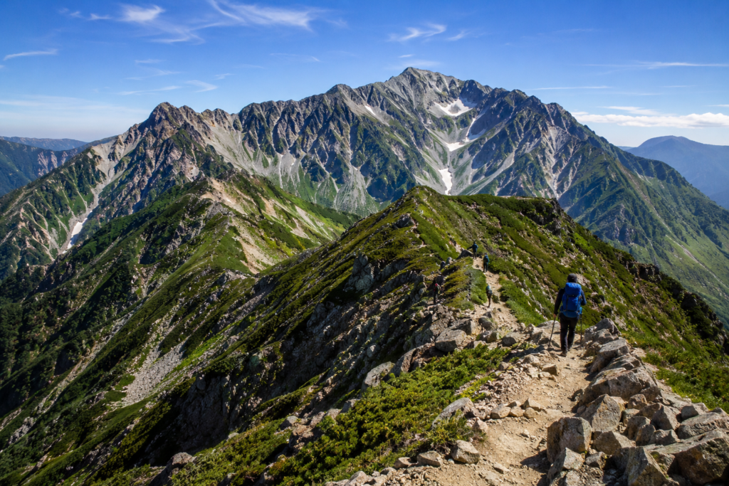
Located in the northern part of Kyushu Island, Oita Prefecture boasts of the Kuju Mountains, one of the most magnificent highland scenes in Japan. It stands above the central plateau of Oita. This vast volcanic complex is part of the larger Aso-Kuju National Park. It is offering up grand craggy peaks, rolling marshlands, seething geothermal vents and vast alpine meadows. It has some of the most rugged wilderness hiking. Most of the natural beauty of the region, all topped off with the local geothermal hot springs, which are located along the mountain bases.
From the extreme to the merry, from Kyushu’s highest peak, Nakadake, to the richest display of boglands, Tadewara Marsh, the Kuju Mountains offer a wide range of outdoor exploration. A successful traverse of this dynamic mountain range requires preparation, knowledge of the route and volcanic conditions.
Table of Contents
Key Peaks
It is essential to know what the Kuju Mountains are before going out to hike them. The range is a part of an interrelated topography of volcanic peaks, valleys. The plateaus that accommodate different levels of skill and stamina in hikes.
- Nakadake (1,791m): The unrivalled roof of Kyushu. A hike up to the top of Nakadake provides a panorama of the central Kyushu region.
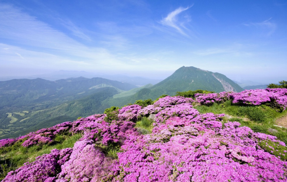
- Kujusan (1,787m): A high peak, slightly lower than Nakadake. It was historically regarded as the main symbolic peak of the range and has high rocky slopes and wide summit ridges.
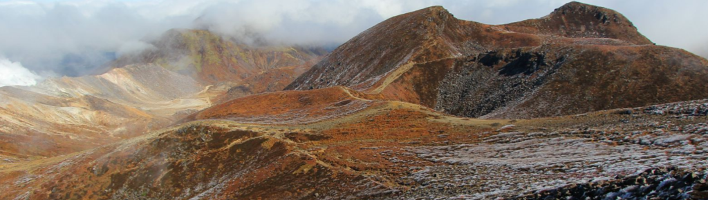
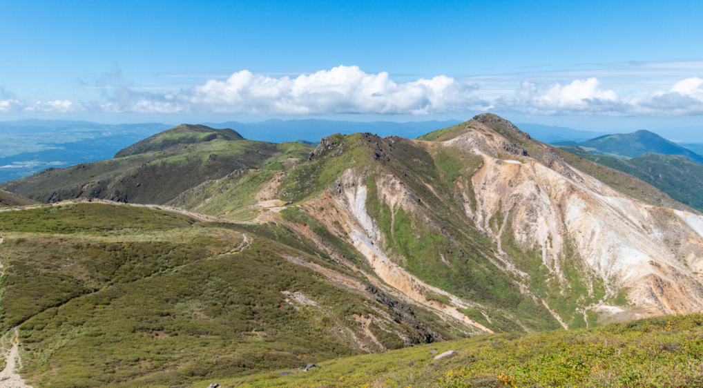
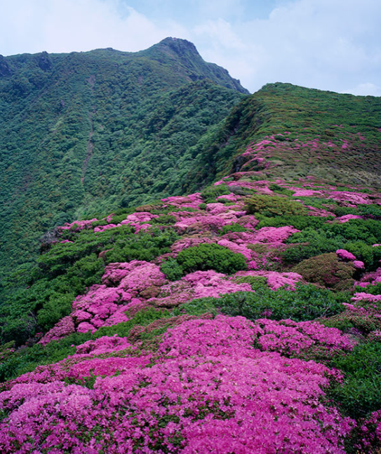
- Hossho-zan (1,764m): Famous for its outstanding sheer cliffs and its nearness to the active sulfur springs, it is a popular place to go for hiking with a special interest in volcanic scenery. It is a multi-peaked mountain popular for its colourful blooms of pink alpine azaleas in early spring, and is named Mimata-yama.
- Bogatsuru Marsh: A high-altitude wetland basin at 1,300 m between the peaks. It is a designated Ramsar wetland site, and a popular backcountry camping location.
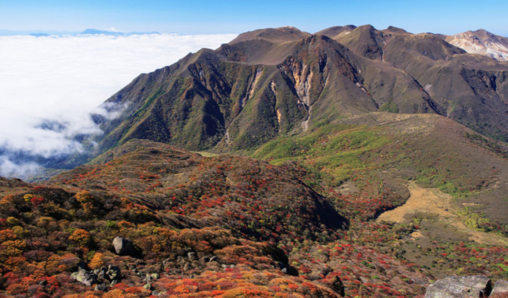
Geographic principles of the Kuju Mountains
When undertaking a trek in a high-altitude volcanic area, it requires a scientific approach to the logistics, safety and practical implementation. These are the “must-do” things to help organise your trip to the Kuju Mountains.
Step 1
Analyse and assess the geological status and weather reports. Safety starts long before you get to the trailhead. The Kuju Mountains are geologically active, and there are fumaroles (steam and sulfur gas vents) near the Hossho-zan constantly releasing steam and sulfur gas.
Before making a trip, check the weather forecasts and volcano alert information from the Japan Meteorological Agency (JMA). Make sure the concentration of sulfur dioxide is not too high along the route you intend to take; also look out for unexpected weather conditions such as rain or fog clouds that may make it difficult for one to see points that are high on the ridge.
Step 2
Selecting a trail that’s right for you means a safe and enjoyable trip, depending on how much time you have.
Makinoto Pass to Nakadake Loop: The most popular high-ridge trail leading from 1,330m to the highest point of Kyushu along paved trails, wooden steps and rocky ridges.
Chojabaru Trail: Tadewara Marsh – A popular, lower-level trail for the beginner, winding through protected marshlands and undisturbed oak forests.
Chojabaru to the Bogatsuru Basin: A moderate valley trail that will take you into the backcountry for those overnight campers wishing to go a little further to the far-off Bogatsuru campsite.
When going on an adventure in the Kuju Mountains, it’s crucial to select a path suitable for your group.
Step 3
The use of the correct equipment is essential for the region’s many exposed ridges and rough rocks.
Hiking boots should be sturdy and provide good ankle support for rocky ground and dry volcanic scree. Pack a moisture-wicking, synthetic or wool clothing layer, a hard-shell jacket that is windproof and waterproof – no matter the morning conditions. Bring at least 2 litres of water per person, high-energy snacks, a headlamp and a physical topo map along with “offline GPS tracking”.
Step 4
Establish transportation routes to the mountain passes.
To access the central trailheads, care needs to be taken in organising local transport.
From Bungo-Nakamura Station or Yufuin Station, take the local bus for Chojabaru or Makinoto Pass from the JR Kyudai Main Line. Access the mountain by car – the Yamanami Highway (Route 11) is one of Japan’s most scenic routes! Be ready to use Makinoto Pass in the early morning, as parking spaces fill up quickly on weekends.
Step 5
After entering onto the trail, keep close attention to the high ridges.
Follow the trail ribbons, wooden posts and yellow rock paint. Stay on paths and refrain from crossing certain areas, particularly near steep drop-offs and sulfur-venting areas of Hossho-zan. If dense mountain fog sets in (as often happens in the Kuju Mountains), stop at a known landmark until visibility improves, or carefully backtrack along the ascent line you marked on the map.
Step 6
It is everyone’s duty to keep the alpine character of the national park unchanged.
Submit a hiking declaration (Tozan-todoke) at the registration box at the trailhead, or submit it online through the Japanese Compass safety portal. Take out all trash; only use the boardwalks when crossing sensitive marsh areas such as Bogatsuru; do not disturb native plants or wildlife.
Step 7
It’s impossible to do a mountain adventure without exploring the area’s abundant geothermal legacy.
Once you reach the base of the mountain, check out the many onsen villages located nearby, like Sujiyu Onsen or the historic Kurokawa Onsen. Soaking in the mineral-rich thermal waters alleviates tired muscles and relaxes the body after a day of trekking in the Kuju Mountains.
Essential Route Statistics
Makinoto Pass to Nakadake & Kujusan Loop
Distance: 10.5km | Time: Approx 5.5 hours | Level: Moderate | Ascent: 650m | Descent: 650m
Highlights: Panoramic ridge walks, wide vistas of active vents and access to Kyushu’s highest point.
The path is paved and clearly marked. This pleasant hike follows a gradual descent and avoids rugged and rocky sections.
Hossho-zan Ridge Scramble
The trail is 8.0 km long and takes about 4.0 hours to complete. Distance: 8.0 km | Duration: ~4.0 hours | Difficulty: Strenuous
Key attractions: Volcanic crater close-ups, steep rock climbing and rugged rock formations.
Best Seasons to Visit
The Kuju Mountains experience amazing seasonal changes throughout the year; each visit will be different.
Spring (Late May to Early June)
Miyama-kirishima (alpine azaleas) put on world-famous showers of flowers in late spring. The slopes of Mimata-yama and Hizen-yama are covered with pink and magenta flowers, attracting flower lovers from all over Japan.
Fall (September to October)
In the summer months, the high marshes are more colourful, and the mountain air is cooler than the humid lowlands of Japan. Sunrise ridge hikes make for a good sunny morning.
Autumn (October – November)
The valleys and ridges turn golden red, orange and gold in the fall. The fall foliage around Bogatsuru Marsh makes autumn one of the best seasons for photography.
Winter (December-March)
High summits are covered with snow and sparkling rime ice in the winter. With crampons and thermal gear, experienced winter trekkers can enjoy solitude on snow-covered ridges in the Kuju Mountains.
Planning Your Alpine Experience
The Kuju Mountains are the highlights of Kyushu, from their lofty volcanic summits to their relaxing lowland thermal springs. With proper precautions, environmental considerations and your experience level, you can navigate this amazing mountain paradise with confidence.
