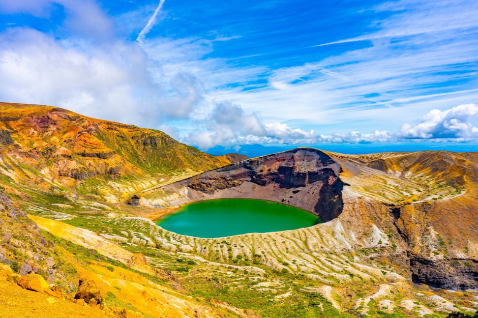
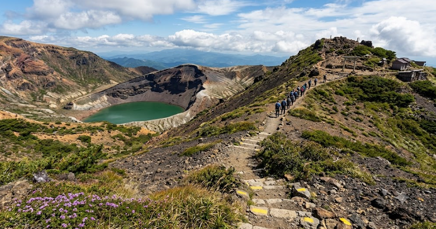
The Okama (Zao) Crater Lake Hike is one of Tohoku’s most spectacular outdoor adventures. It is located on the high plateau of the volcano separating Miyagi and Yamagata Prefectures in northern Honshu. A complex, active volcanic group renowned for its dramatic seasonal contrast from the wintertime world-famous ‘snow monsters’ (Juhyo). It transitions to the spectacular emerald-coloured views of the crater during summer. Okama, a circular, highly acidic crater lake, is at the centre of this alpine landscape. In Japanese, okama translates to a traditional cooking pot.
The waters of Okama, also known as the “Five-Color Lake” (Goshiki-numa). It is subject to dynamic changes in colour from deep turquoise to vibrant jade and dark emerald with the changing of the seasons. In accordance with the intensity of the sunlight and cloud cover. The Okama (Zao) Crater Lake Hike is a once-in-a-lifetime experience. It will leave you with panoramic views as you traverse through the rugged volcanic ridges, steam vents, and expansive alpine tundras. From hikers who have already been through it to those taking a day trip for a high-altitude stroll, here’s a comprehensive guide to help you go to the top of Zao.
Table of Contents
- Topography and Key Landmarks of Mount Zao
- Step-by-Step Method: Okama (Zao) Crater Lake Hike
- Step 1: Check the Volcanic Safety Status and Weather Conditions:
- Step 2: Selecting the Best Trail Route for Your Level of Experience
- Step 3: Ensure Transportation and Transit Timetables
- Step 4: Set Up Equipment for Alpine and Volcanic Conditions
- Step 5: Carry Out the Ridge Navigation with Volcanic Vigilance
- Step 6: Always Adhere to Environmental Ethics
- Step 7: Relax in the Base Onsen Villages
- Route Summaries and Profiles
- Seasonal climatic conditions – Okama (Zao) Crater Lake Hike
- Planning Your Tohoku Volcanic Adventure
Topography and Key Landmarks of Mount Zao
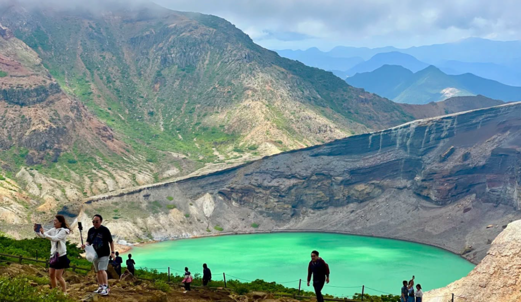
Knowledge of the layout of the volcanoes around the lake will enable a smooth and well-structured excursion. The main feature of the range is Okama Crater Lake (1,380m). This is a very acidic lake. It is about 360 meters in diameter and 27 meters deep. It is totally devoid of life, surrounded by high and multi-colored volcanic walls.
Kattadake (1,758m): This peak, just south of the crater, has the ruins of the Kattamine Shrine. It is the highest point around Okama, which is available as an observation location.
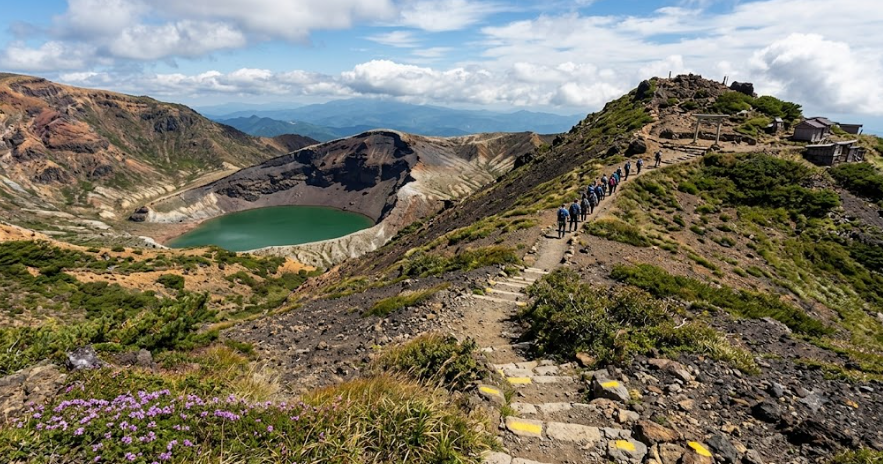
Kumanodake (1,841m): The summit of Mount Zao is located north of the crater. Kumanodake has a large stone-strewn plateau and old stone cairns. It has panoramic views of the whole Tohoku region.
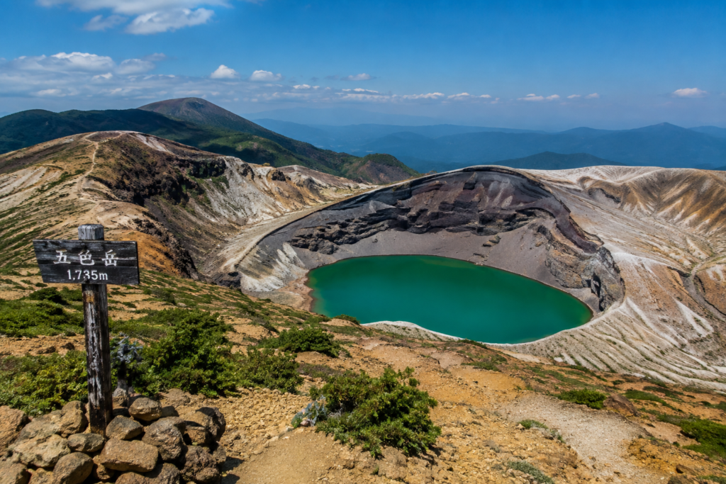
Goshikidake (1,735m): Active volcanic cone on the immediate northern edge of the Okama crater basin.
Step-by-Step Method: Okama (Zao) Crater Lake Hike
Weather, logistics, and trail protocols are important to keep in mind when traversing a high-elevation volcanic area. Use this 7-step execution plan to help you make your trek a fun one.
Step 1: Check the Volcanic Safety Status and Weather Conditions
The first steps to safety start long before you get to the trailhead. The JMA is continuously monitoring Mount Zao, an active volcano.
Before setting out on your Okama (Zao) Crater Lake Hike, check the current JMA volcanic alert level. The higher the warning level, the more activity takes place. More of the high ridge trails will be accessible. Level 1 means normal activity, with all high ridge trails accessible, and higher levels result in automatic closure of the perimeter of the crater. Also, keep an eye on mountain forecasts, since heavy fog, high ridge winds and abrupt rain can easily make it hard to see trail signs.
Step 2: Selecting the Best Trail Route for Your Level of Experience
Plan your hikes according to your fitness, time, and mode of transportation.
- A: For the Summit Ridge Walk (Easy – 1.5 to 2 Hours) drive or take a bus to the Zao High-Line toll road. Follow the path directly from the Kattadake Bus Terminal to Kattadake Shrine. Further, the principal 45-minute viewing platform follows well-paved stone paths, and then a 45-minute ascending path along a ridge to Kumanodake.
- B: Zao Onsen to Dokkonuma by Zao Ropeway, then on foot to Okama (Moderate/Strenuous – 5 to 6 Hours): Take the Zao Ropeway from Zao Onsen town to Jizosancho Station and then take a classic alpine trek to the crater rim via Jizodake and Kumanodake.
- Option C: Kattadake Pass Traverse (Moderate – 3 to 4 hours): A beautiful route that rises steadily from the lower passes through wooded routes to the exposed volcanic plateaus.
Choosing which trail option you want to take will ensure your Okama (Zao) Crater Lake Hike matches your group’s abilities.
Step 3: Ensure Transportation and Transit Timetables
Transportation to high-altitude areas is very dependent on transportation routes and weather.
If travelling by public transport in the operating season (usually from the end of April to the beginning of November), take direct highway buses from JR Sendai Station or JR Shiroishi-Zao Station to Zao Kattadake. You can also take a bus from Yamagata Station to Zao Onsen and use the Zao Ropeway system. The Zao Echo Line highway will go around the lake, with the Zao High-Line toll road branch going directly all the way up to the Zao lake summit parking area.
Step 4: Set Up Equipment for Alpine and Volcanic Conditions
Weather conditions on the alpine ridges in the Zao range are very changeable, so it’s a good idea to have a range of layers.
Bring sturdy, well-worn hiking boots with adequate ankle support to hike over loose volcanic scree, sharp basalt rock, and uneven stone trails. Layering is important: a moisture-wicking bottom layer, an insulating mid-layer, sunblock, and a windproof/waterproof outer shell jacket. Sunglasses, sunblock, hat with a brim, headlamp, physical topographic map, and at least 1.5 to 2 litres of water per person.
Step 5: Carry Out the Ridge Navigation with Volcanic Vigilance
After entering the trail, follow the path on the exposed ridge sectors.
Follow the marked trails, indicated by wooden posts, yellow rock markers, and traditional stone cairns (kerun). Be aware of and watch for emissions of steam or accumulation of gases, especially on windless, calm days. When the fog settles over the plateau between Kumanodake and Kattadake (as often happens on the Okama (Zao) Crater Lake Hike), slow down and take care to keep going from cairn to cairn. Maintain the right orientation.
Step 6: Always Adhere to Environmental Ethics
The conservation of the pristine and fragile alpine ecology is an important aspect of the Zao Quasi-National Park.
Hike by submitting a Tozan-todoke (hiking register) either with a computer or on paper at the trailhead box or at a local street, without straying from the set paths and boards so as not to trample or damage fragile alpine plants such as the rare Komakusa (Dicentra peregrina) flowers that grow on the scree slopes. Pick up all garbage, do not handle or enter the acidic lake water, and leave natural rock formations alone.
Step 7: Relax in the Base Onsen Villages
Conclude your trip to the mountains with an experience of Tohoku’s world-class geothermal culture.
When coming out of your Okama (Zao) Crater Lake Hike, go to Zao Onsen on the Yamagata side of the lake or Togatta Onsen on the Miyagi side of the lake. A traditional open-air bath (rotenburo) is the perfect end to your alpine adventure with its highly acidic, sulfuric thermal waters, which moisturise and refresh tired muscles.
Route Summaries and Profiles
Kattadake to Kumanodake Ridge Loop
Grouping: Trail: 3.1 km | Grouped by: 4.8 km | Maximum Group: 6 | Years: 1998 | Frequency: Very Frequently | Accessibility: All Ages | Usage: Public | Maintained: By the owner | Type: Downstream | Condition: In Excellent Condition
Walking on the high plateau, the direct overlook of the craters of Kattamine Shrine and the other shrines is included in the Profile.
Travellers can take a ropeway from Zao back to Okama Traverse.
Elevation gain: 520 m | Difficulty: Moderate | Distance: 9.5 km | ~5.0 Hours
Profile: Jizo Statue, Dokkonuma pond, alpine flower fields, Kumanodake peak.
Seasonal climatic conditions – Okama (Zao) Crater Lake Hike
Spring (Late April to June)
In late April, the Zao Echo Line highway is opened, surrounded first of all by dramatic snow walls. In the spring, it’s a time of fresh air, snow melts, and alpine flowers pop up over dark volcanic dirt.
Fall (September to October)
The summer offers warm sunny days, blue skies, and wildflowers, such as Komakusa, which grow in the alpine areas. Although high summer temperatures are reached in lowland Japan, the temperatures along the Zao ridge stay pleasantly cool.
Autumn (September–October)
During autumn, Mount Zao’s slopes are coated with a beautiful blanket of fiery reds, deep oranges, and gold. One of the most popular seasons for photographers, it’s Fall foliage framing the emerald waters of Okama.
Winter (November to April)
In the wintertime, heavy snowfall over the range makes high-altitude roads impassable. The lake is covered with ice. Temperatures drop below freezing. People abandon hiking. They switch to snowshoeing and backcountry skiing to enjoy the “snow monsters” (Juhyo) that form around the lake.
Planning Your Tohoku Volcanic Adventure
The Okama (Zao) Crater Lake Hike is one of Japan’s best mountain hikes, with dramatic geological structures and moving emerald waters. It captivates visitors with its rich geothermal relaxation. With these preparations, safety measures, and an understanding of the dynamic alpine landscape, your trek across Mount Zao’s volcanic crest is sure to be safe, fulfilling, and memorable.
