If you love nature and mountain scenery, hiking in the Shiretoko Peninsula is an experience you will not forget. Located in the far northeast of Hokkaido, Japan, this UNESCO World Natural Heritage site is one of the country’s most beautiful and wildest places, with green forests, tall volcanic mountains, waterfalls and peaceful lakes. The weather can change quickly, so prepare well before you start your hike.
Whether you prefer a short, easy walk or a long mountain climb, Shiretoko has a trail for you. This guide covers the main hiking trails, how to get there, the best time to visit and the key safety tips for your trip.
Table of Contents
Shiretoko Five Lakes Trail
The Shiretoko Five Lakes (Shiretoko Goko) are five peaceful lakes hidden in old-growth forest, with the Shiretoko mountains reflected in the water on calm days. It is the most popular walk on the peninsula and the easiest way to experience its wild beauty.
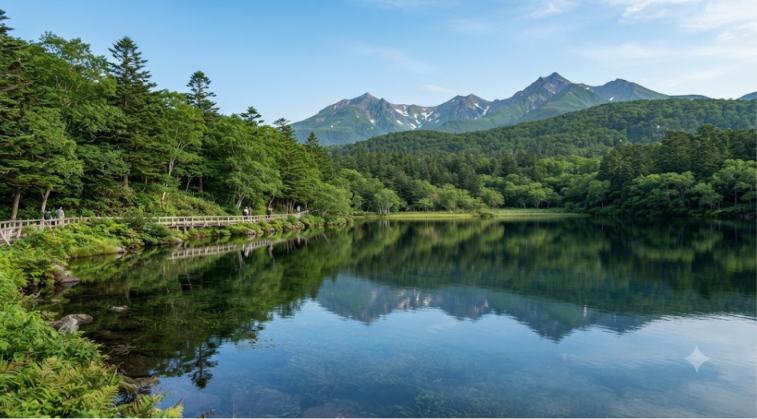
There are two ways to walk here. The elevated boardwalk is about 800 m long, protected by an electric fence, and is free to use, so it suits almost everyone. The ground trail is a loop of about 3 km that takes you to all five lakes through the forest. Because this is brown bear country, the ground trail is regulated. From around May 10 to July 31 you can only enter with a registered guide. At other times you must attend a short safety lecture and pay a fee at the Five Lakes Field House before walking it yourself. Dates and fees change from year to year, so check the official Five Lakes information before you go.
- Distance: About 3 km (ground trail loop)
- Time: 1.5 to 3 hours
- Difficulty: Easy to Moderate
This path is best for families, beginners and anyone who wants a first taste of Shiretoko without a long climb.
Mount Rausu Trail
The Mount Rausu Trail is a challenging hike that suits experienced hikers. It leads to the summit of Mount Rausu (1,661 m), the highest peak on the Shiretoko Peninsula.
This is a long hike, so carry enough food and water and wear sturdy hiking shoes. As you climb, the path takes you through forest and then over rocky ground, with wide views opening up near the top.
From the summit on a clear day you can see the surrounding mountains and the Sea of Okhotsk. The views make the long climb well worth the effort.
- Distance: About 13 km round trip
- Time: 8 to 10 hours
- Difficulty: Difficult
This path is best for experienced hikers who are ready for a long and challenging mountain adventure.
Mount Io Trail
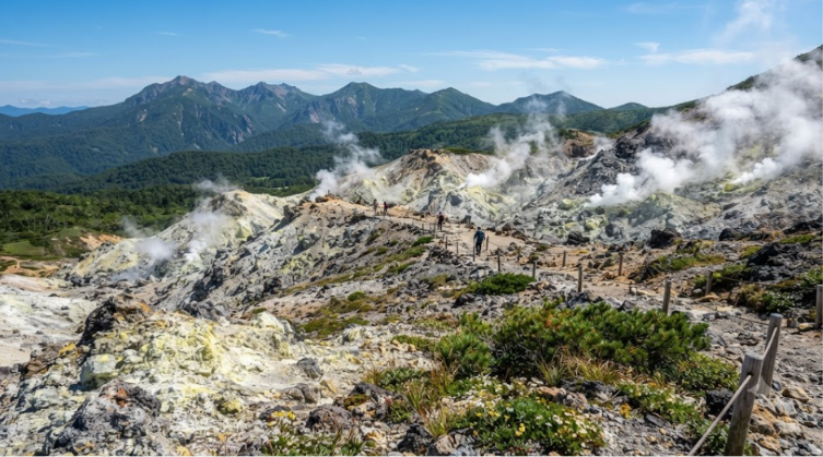
Mount Io is an active volcano which is located in the Shiretoko area. This route is a great choice for people who want to see Shiretoko’s natural beauty.
As you walk on this path, you can see some places with big rocks. You may also see small plants growing in the mountain areas.
The trail gives you views of the surrounding mountains and wild scenery. Parts of the path are difficult, so be well prepared and wear sturdy hiking shoes.
- Distance: About 6 to 8 km
- Time: 5 to 7 hours
- Difficulty: Moderate to Difficult
This path is perfect for hikers who enjoy mountains, volcanoes and wild natural scenery.
Furepe Waterfall Trail
This journey is short and easy, which makes it a great choice for people who do not want a long hike.
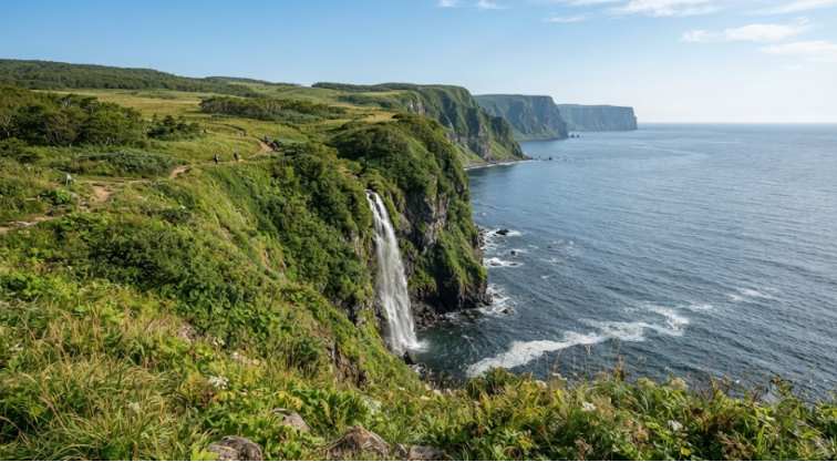
The trail leads through a peaceful natural area to a viewpoint with a beautiful view of Furepe Waterfall.
From the viewpoint you can enjoy the waterfall and the surrounding nature. It is a good option for families, children and anyone who wants a relaxing walk.
- Distance: About 2 km round trip
- Time: About 1 hour
- Difficulty: Easy
Choose this route if you want a short hike that still shows off the beauty of the area.
Shiretoko Hiking Trails Summary
| Trail Name | Distance | Time | Difficulty | Key Highlights | Best For |
|---|---|---|---|---|---|
| Shiretoko Five Lakes Trail | 3 km | 1.5 – 3 hours | Easy – Moderate | 5 lakes, mountain reflections | Families & beginners |
| Mount Rausu Trail | 13 km round trip | 8 – 10 hours | Difficult | Summit views, Sea of Okhotsk | Experienced hikers |
| Mount Io Trail | 6 – 8 km | 5 – 7 hours | Moderate – Difficult | Active volcano, rocky terrain | Volcano & mountain fans |
| Furepe Waterfall Trail | 2 km round trip | 1 hour | Easy | Furepe Waterfall viewpoint | Families & short walks |
How to Reach Shiretoko Peninsula
Most visitors first travel to Hokkaido, the northern island of Japan, and then continue by road to the Shiretoko Peninsula in the far northeast.
There are two main ways to get around Shiretoko: a rental car or the local buses, which run infrequently. If you would like local knowledge about the area’s nature and wildlife, you can also hire a guide.
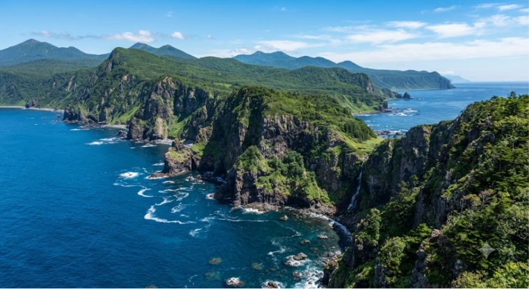
There are two towns which are close to this place and they are Utoro and Rausu. These two towns are the main starting points for your journey. You can also find some places to stay, restaurants, shops and other useful facilities in these towns.
If you want to explore different parts of this place by stopping and taking your own time to enjoy it, then taking a rental car is a good choice. You will enjoy it more if you rent a car because you can see other nearby places like waterfalls and famous places.
Best Time to Hike and Safety Tips
The main hiking season for the mountain trails runs from about July to mid-September, when most of the snow has melted and the weather is at its most stable. The Shiretoko Pass road between Utoro and Rausu is usually closed by heavy snow in winter, so plan your visit for the warmer months.
Shiretoko has one of the highest brown bear populations in Japan, so take bear safety seriously on every trail:
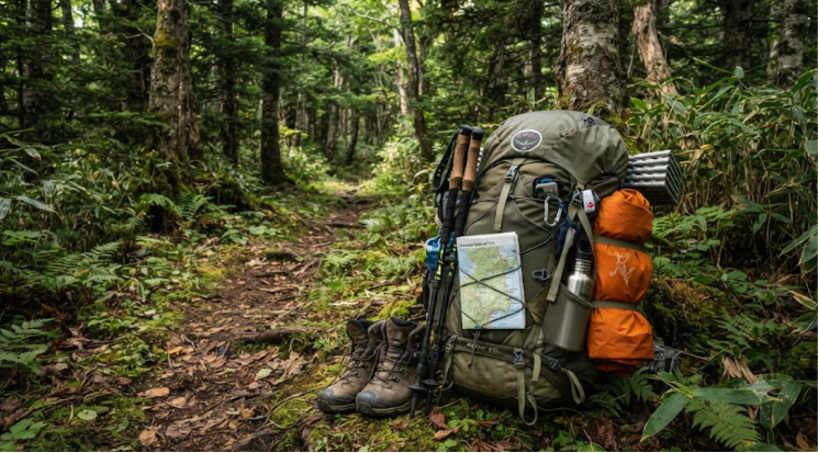
- Carry a bear bell and bear spray. Both can be rented at the trailhead hut near the Mount Rausu trailhead if you do not have your own.
- Keep food sealed and take all rubbish with you, because bears are very sensitive to food smells.
- Check the bear sighting notices at the trailhead and follow any trail closures.
- Start early, hike in daylight and make noise in thick forest so bears know you are coming.
- Pack warm, waterproof layers, as the weather can change quickly and the wind can be strong near the summit of Mount Rausu.
How We Would Plan Shiretoko
Shiretoko rewards a two-step plan: start with the easy, protected walks, then decide on a mountain once you have seen the weather and the bear notices. This is how we would use the trails in this guide:
| Trail | Stats in this guide | We would choose it if you… |
|---|---|---|
| Five Lakes boardwalk | About 800 m, elevated, protected by an electric fence and free | want the most accessible walk, with no guide needed |
| Five Lakes ground loop | About 3 km, 1.5–3 hours | can book a registered guide in the May–July window, or attend the safety lecture at other times |
| Furepe Waterfall | About 2 km round trip, about 1 hour | want a short, easy outing with children |
| Mount Io | About 6–8 km, 5–7 hours, moderate to difficult | are comfortable on rocky volcanic ground |
| Mount Rausu | About 13 km round trip, 8–10 hours, difficult | are experienced, and have checked the current bear alert level |
We would treat the boardwalk as the default Five Lakes choice for anyone without a guide in early summer, since the guide says the ground trail is guide-only from around May 10 to July 31. For every trail, we would check the bear notices at the trailhead and rent a bell and spray at the hut near the Rausu trailhead if we did not own them. For current alert levels and the full route description, see our Mount Rausu and Shiretoko Traverse guide.
The Beauty of Hiking in Shiretoko Peninsula
This is a wonderful place for people who love nature and hiking. In this journey you can see beautiful lakes, waterfalls, green forests and big mountains.
You can choose any one of the routes depending on your time and experience. Before you start your hike, make sure that you plan your trip well and don’t forget to carry the things you need. If you love to hike, then explore some other hiking places like Oku-Chichibu Traverse.
If you love peaceful places with beautiful views and love to do outdoor adventures then the Shiretoko Peninsula is a great place to visit.
