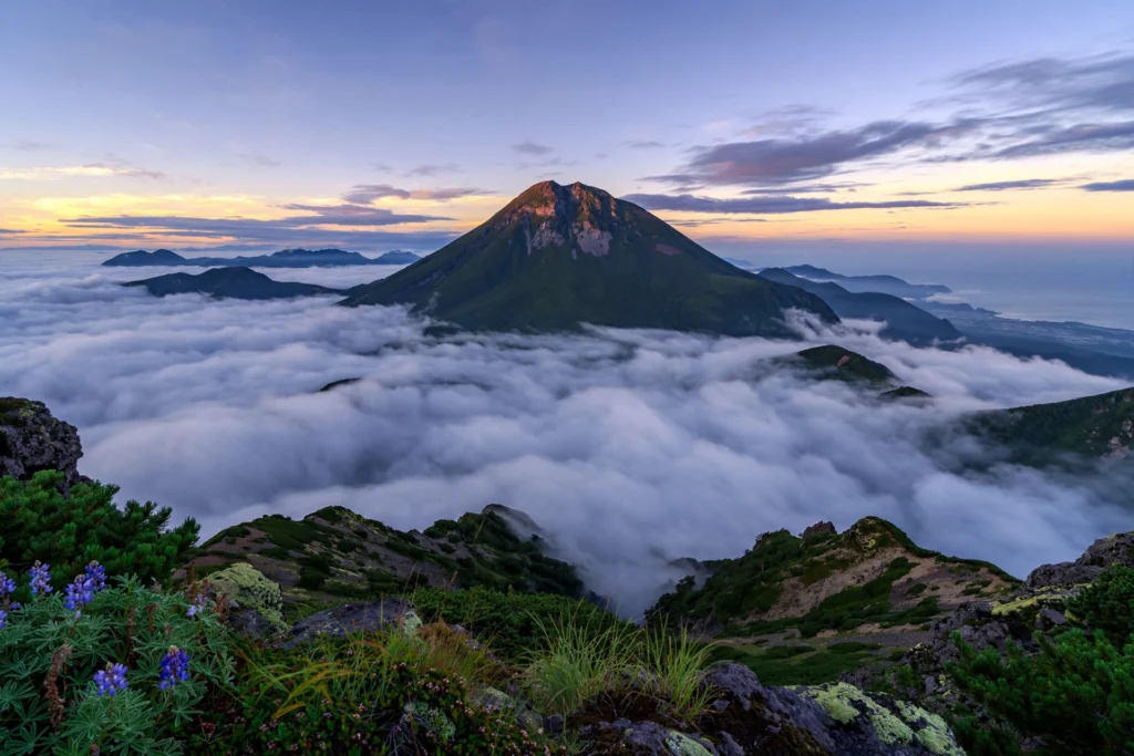
If you love hiking and want an experience to enjoy nature then Mount Rausu and the Shiretoko Traverse are great places in Japan you need to visit.
The Shiretoko Peninsula is one of the most beautiful and wild places in Japan. It is also a UNESCO World Heritage Site because of its rich wildlife and beautiful nature. This mountain is the highest mountain on the Shiretoko Peninsula. If you love adventurous hikes, seeing beautiful wildlife and finding the best views, then you can try the Shiretoko Traverse. In this place you can see so many amazing things.
Table of Contents
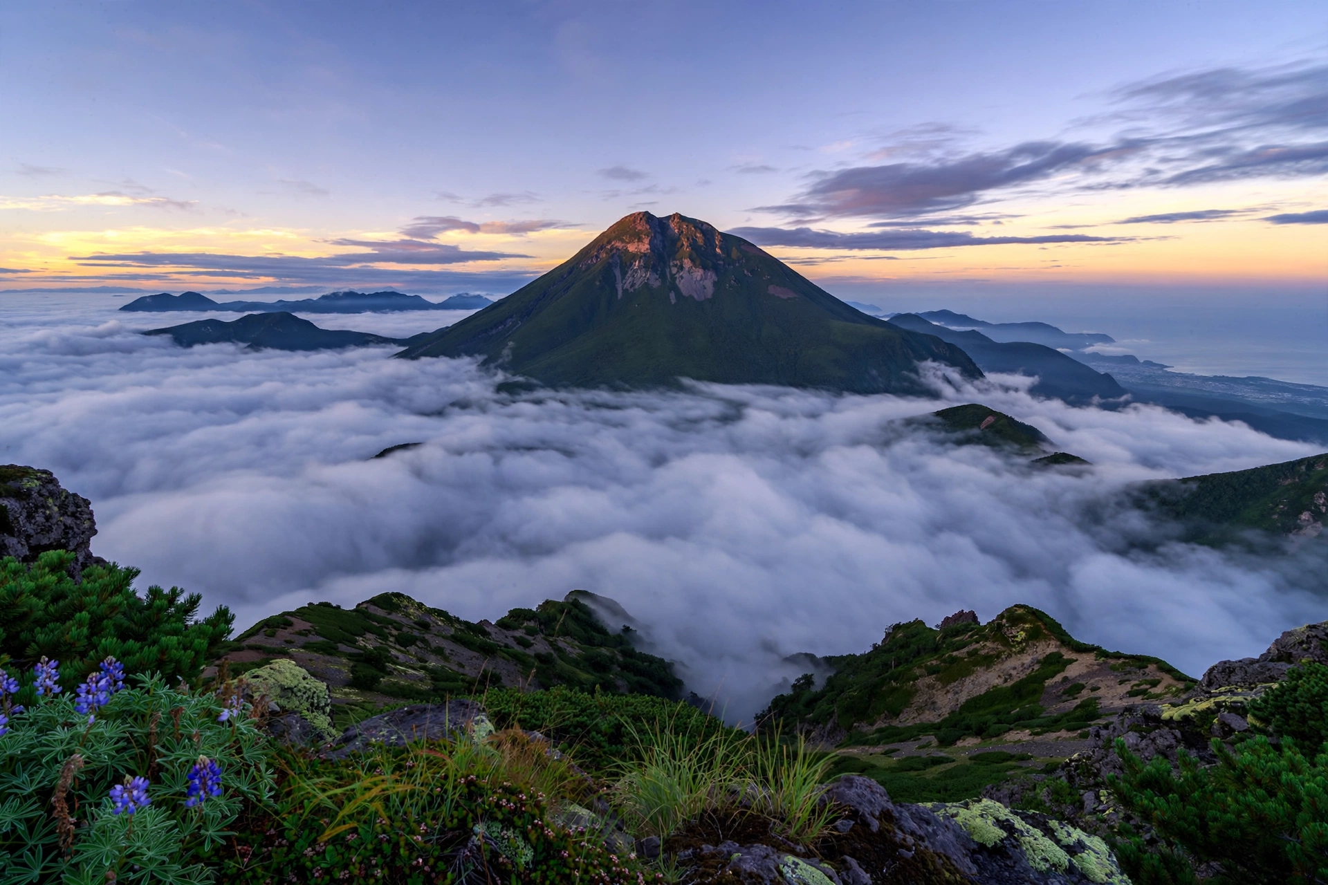
Adventure Begins In Hokkaido Today
It doesn’t matter even if you are hiking for the first time or if you are an experienced hiker, you will understand everything about Mount Rausu and the Shiretoko Traverse Guide so that you can plan your trip properly.
How We Would Approach Rausu
Rausu is a trip where the bear situation decides everything, so our plan starts with the trail status, not the route. We would check the current alert level with the town of Shari or the Shiretoko Nature Center before travelling, treat Level 4 as a firm no, and rent bear spray at one of the visitor centres, as this guide describes, rather than rely on a bell alone.
| Option | Stats in this guide | We would choose it if you… |
|---|---|---|
| Day hike from Iwaobetsu | About 13 km round trip, 1,448 m of ascent, about 9 hours for strong hikers | are very fit, can start at first light and have practised drawing bear spray |
| Overnight at Rausu-daira | Space for five to six tents, four to five hours from the trailhead | want the summit without a single huge day |
| Shiretoko Traverse | Two days along the volcanic spine, with a saddle campsite and bear-proof bins | have real bear-country experience, since this guide calls it expert level |
On the trail, we would keep up constant noise through the marshy Gokuraku-daira, carry the portable toilet bag the guide says is mandatory on the traverse, and bring light traction for the snowfield in July. For getting there, the bus from JR Shari-Shiretoko Station stops about 2 km short of the trailhead, so we would allow time for the walk. For more bear-country planning, see our Daisetsuzan guide and Shiretoko Peninsula guide.
Where is Mount Rausu?
This mountain is located in eastern Hokkaido in Japan. The height of this mountain is 1,661 meters, which is 5,449 feet and it is the tallest mountain in the Shiretoko mountain range.
This mountain is on the beautiful Shiretoko Peninsula in the Sea of Okhotsk. This place is famous for its green forests, big mountains with clear waterfalls, and mainly for its rich wildlife. While travelling you will see some animals like deer, foxes and many different birds.
Mount Rausu is a great place for people who love to spend time in nature and enjoy outdoor activities. Most people come here to enjoy hiking, take some beautiful photos, watch the birds in their beautiful nests, and finally to see the peaceful beauty of the wild Shiretoko Peninsula.
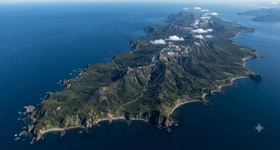
Eastern Hokkaido Mountain Landscape View

Unforgettable Views Await Every Hiker
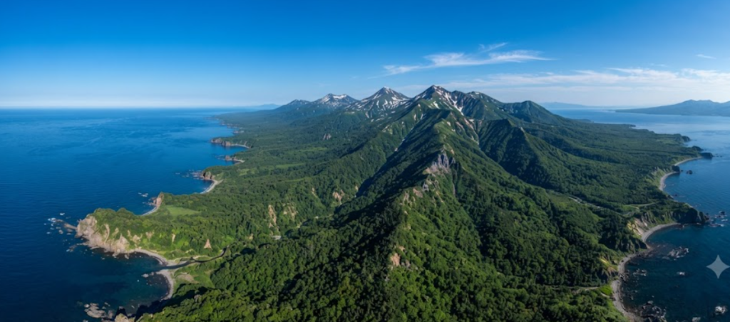
Explore Japan’s Wild Natural Beauty
Bear Safety: Read Before Planning
Shiretoko holds one of the densest brown bear populations in Japan. The Ezo brown bear (higuma), a close relative of the grizzly, is significantly larger and more dangerous than the black bears of Honshu.
In August 2025, a 26-year-old hiker was killed by a brown bear while descending Mount Rausu. It was the first fatal attack on Shiretoko since its UNESCO inscription in 2005. Authorities closed all three Rausu trails for approximately eleven months.
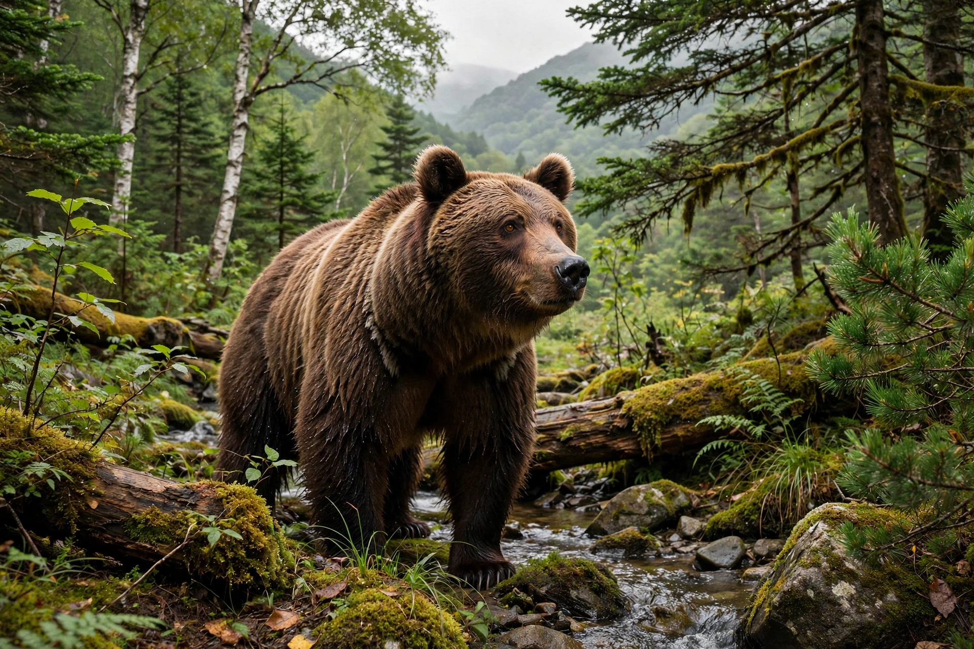
Trails reopened in July 2026 under a four-level bear alert system. Level 1 indicates normal conditions; Level 4 closes the trail. Rangers post the current level at trailheads, and conditions can change daily. Days after the 2026 reopening, a hiker was charged near the Iwaobetsu trailhead; he repelled the bear with spray and escaped unhurt, but officials closed the trails again before reopening on July 16.
Hiking Rausu remains possible with proper preparation. Check current trail status with the town of Shari or the Shiretoko Nature Center before departure, as conditions change rapidly.
Standard Route: Iwaobetsu to the Summit
The primary approach begins at the Iwaobetsu trailhead on the Shari side, at approximately 213 metres near Iwaobetsu Onsen. The round trip covers roughly 13 kilometres with 1,448 metres of elevation gain. Strong hikers complete it in about nine hours; plan for a full day regardless of pace.
The route follows distinct stages. The initial forest climb leads, after about ninety minutes, to the only reliable water source on a short spur to the left. Fill bottles here; water becomes scarce above.
Gokuraku-daira, a marshy flat beyond, is prime bear territory. Maintain noise through this section: bells, clapping, or calling out. Quiet passage increases encounter risk.
Above the marsh, switchbacks ascend a rocky gully. In early summer this holds a continuous snowfield, typically melting by August, though patches may persist. Check conditions and carry light traction for July ascents.
The gully opens onto Rausu-daira, a flat area accommodating five to six tents, four to five hours from the trailhead. The trail divides three ways here. The right fork scrambles to the summit, a cluster of lava domes. On clear days, Kunashiri Island lies visible to the east and Mount Shari to the west.

Mount Rausu stands at 1,660 metres, the highest peak on the Shiretoko Peninsula and one of Japan’s 100 Famous Mountains. The official climbing season opens with a festival on July 3 each year.
Shiretoko Traverse: Rausu-daira to Io-zan
At the three-way junction on Rausu-daira, the left fork continues along the peninsula’s volcanic spine toward Mitsumine and Mount Io (Io-zan, Sulphur Mountain). This is the Shiretoko Traverse.
Few hikers attempt it. The traverse offers two days of ridge walking through dwarf-pine forest along a chain of volcanic peaks that receive minimal traffic.
Logistics require preparation. A designated campsite at a saddle around 1,348 metres provides bear-proof food storage bins; all food must go in the bins, none in tents. A portable toilet bag, purchased at the trailhead, is mandatory under the pack-out rule: all human waste is carried out. Water is limited to a spring at about 1,455 metres. The traverse demands greater bear awareness than the day hike, as it involves overnighting in bear territory. This is expert-level Shiretoko.
Bear Safety Protocol
Carry bear spray and know how to deploy it. Japan’s 2026 guidelines specify minimum 7.5-metre range, six seconds or more of spray duration, and one to two percent capsaicin concentration. Purchase costs 10,000 to 20,000 yen; spray cannot be carried on aircraft, so most visitors rent. The Shiretoko Foundation rents spray for approximately 1,100 yen per day, available at the Shiretoko Nature Center (Utoro side) and the Shiretoko Rausu Visitor Center (Rausu side). Practise drawing the canister before starting the trail.
Wear a bear bell and hike in a group. Bells do not deter a determined bear, but noise prevents surprise encounters, which cause most injuries. Weekends carry lower risk than weekdays due to higher foot traffic.
Read the warning boards at the trailhead. Rangers post recent sightings and the current alert level. Level 4 means the trail is closed.
Store food properly. Use the bear-proof bins at the saddle campsite. Elsewhere, keep food sealed and separated from sleeping areas.
For context: Japan recorded more than 50,000 bear encounters in the year ending March 2026, roughly double the previous record. Shiretoko sits at the sharp end of this trend.
Season and Access
The practical hiking season runs from early July to mid-September. Snow lingers into July; by mid-September days shorten and snow may return. Some sources extend the season into October, but conditions deteriorate rapidly.
Alpine flowers, including the mountain harebell, bloom in the brief summer window. Autumn colours arrive early, often by late September, due to the northern latitude.
Access requires effort. By car from Shari town, follow Route 335 east for about 40 kilometres, then Route 93 into the park. Trailhead parking is extremely limited; arrive early or park along the road. By public transport, take a bus from JR Shari-Shiretoko Station to the Iwaobetsu bus stop, then walk approximately two kilometres to the trailhead; the bus does not reach the trailhead itself.
The Shiretoko Pass road (Route 334), connecting Utoro and Rausu over a 738-metre pass, closes in winter, typically late November to late April, usually reopening around Golden Week. In early October it offers some of Japan’s earliest autumn colours.
For accommodation near the trailhead, the Kinoshita Hut at Iwaobetsu operates in summer only, sleeps about thirty, and rents bear spray and bells. It also maintains a basic onsen.
UNESCO World Heritage Status
Shiretoko received UNESCO Natural World Heritage inscription in 2005, recognising the interaction between marine and terrestrial ecosystems driven by seasonal sea ice. This forms at approximately 43 degrees north, the lowest latitude in the Northern Hemisphere where sea ice develops regularly.

The ice drives plankton blooms that sustain fish populations, which in turn support everything from Steller’s sea eagles to sperm whales offshore to the brown bears on the mountain. The name Shiretoko derives from the Ainu “Shiri Etoku,” meaning the far corner of the earth.
🥾 Quick Summary
Location
Shiretoko Peninsula, Hokkaido
Highest Peak
Mount Rausu (1,661 m)
Difficulty
Difficult (Experienced Hikers)
Best Time
July to Early September
Duration
2–3 Days (Traverse)
Must Carry
Water, GPS, Bear Bell & Rain Gear

1 thought on “Mount Rausu and Shiretoko Traverse Guide: Explore Japan’s Wildest Hiking Adventure ”