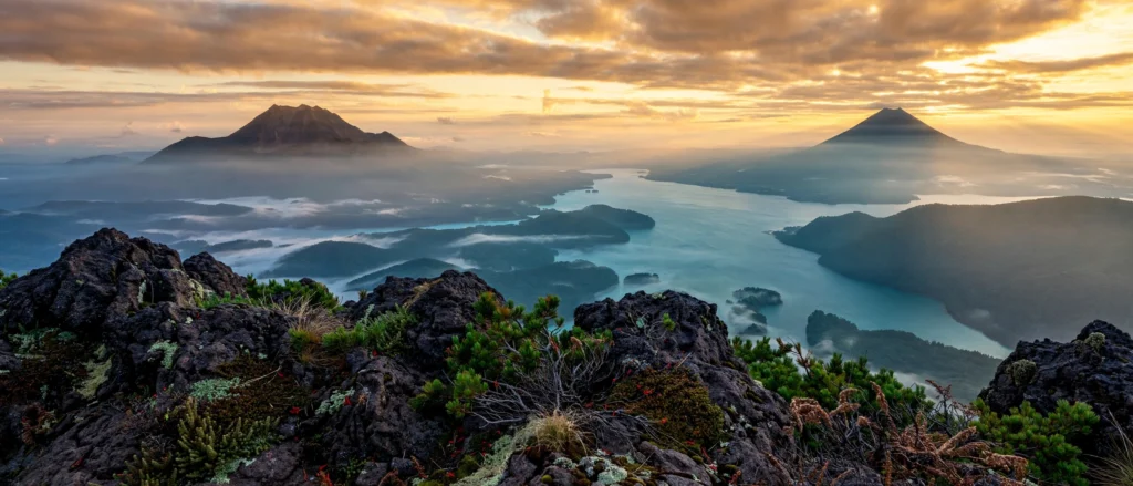
Most hikers who make it as far east as Lake Akan come with one mountain in mind: Mount Meakan, the smoking, 100-Famous-Mountains volcano on the lake’s western shore — and it deserves its reputation. But across the water, rising over the twin lakes of Panketo and Penketo, stands its quieter twin. The Mount Oakan hike is longer, steeper, and far less crowded. On a clear autumn morning, it serves up one of the finest summit panoramas in all of Hokkaido.
Oakan-dake (雄阿寒岳, 1,370 m) is the “male mountain” of the Akan volcanic pair in Ainu tradition — smaller than Meakan, but wilder in feel. There is exactly one official route: a full-day out-and-back. It climbs about 950 metres through primeval forest, past two hidden lakes and over a loose volcanic crux, to a cratered summit with clear-day views from Lake Kussharo to the Shiretoko range. This guide covers the full Mount Oakan hike: the trail, the seasons, the trailhead, bear safety, packing, and the onsen finish at Akankohan.
As with every guide on this site, this one is compiled from official and published sources. That includes the Japan Tourism Agency trail database, the Hokkaido mountaineering federation’s course guide, and trip reports from established Hokkaido hiking writers. In other words, it is research — not a single personal ascent. Treat it as your planning starting point, and always confirm current conditions locally before you set out.
🥾 Mount Oakan Hike: Quick Summary
Everything from the guide below, condensed — plus a few things most guides skip.
📊 Hike Summary
Distance
~11–13 km round trip
Elevation gain
~950 m (summit 1,370 m)
Time
~6–7 hrs round trip
Difficulty
Hard🚌 Getting There
Drive Route 240 from the Akankohan onsen village — the Takiguchi trailhead is about 5 km east, by the dam floodgates at the end of Lake Akan. On public transport, take the Akan Bus from Kushiro Station towards Lake Akan (roughly 2 hours) and get off at the Takiguchi stop, right by the trailhead — about 10 minutes short of the Akanko Onsen terminal.
- The trailhead sits at about 420 m — the same height as Lake Akan’s surface — with a small parking area and public toilets.
- There is no drinking water anywhere on the route, so carry everything you will drink for the full day.
- Buses are infrequent, so note the return times from Takiguchi before you start — miss the last one and you will need a taxi from Akankohan.
- From further afield, Kushiro Airport and Memanbetsu Airport both connect onward to Akankohan by bus or rental car.
🧭 The Route, in Three Legs
Lakeside Walk
Trailhead to Lake Jiro — about 40 minutes return. Trout-patrolled lakes and flat forest; the official warm-up (or a standalone stroll).
Forest Climb to 5th Station
The long grind: old-growth spruce, fir and oak forest, then a steep, loose pull just below the 1,194 m marker. Shaded and relentless.
Ridge & Crater Rim
Dwarf-pine ridge above the 5th station, past the old army weather-station ruins near the 8th station, over an overgrown crater to the summit.
There is only one official course, and it is an out-and-back — the same trail up and down. Near the 5th station, watch for the junction with the abandoned Okurushupe Trail: it is a tempting wrong turn, so stay on the marked main route. The Akan region is famously fog-prone, so start early; the summit spends a lot of time inside cloud, and an early start is your best defense.
📅 When to Hike
🌤️ Weather Check
🎒 What to Pack
💡 Good to Know Before You Go
Elevation
1,370 m
Location
Kushiro City (Akan), Hokkaido
Belongs to
Akan-Mashu National ParkTable of Contents
- Why Hike Mount Oakan?
- Mount Oakan at a Glance
- Oakan vs. Meakan: Which Akan Volcano Should You Climb?
- When to Hike: Best Months, Autumn Color, and the Fog Problem
- Getting to the Takiguchi Trailhead
- The Trail, Step by Step: From the Floodgates to the Summit
- Lake Taro and Lake Jiro: The 40-Minute Warm-Up Walk
- The Crux Below the Fifth Station
- From the Summit: Twin Lakes, Meakan, and the Clear-Day Bonus
- Fire and Myth: Oakan's Volcanic Past and the Ainu "Male Mountain"
- Bears, Deer Trails, and Mountain Safety
- What to Pack for the Mount Oakan Hike
- After the Hike: Onsen and Marimo at Akankohan
- Two-Day Plan: Pairing Oakan with Meakan and Akan-Fuji
- Mount Oakan Hike FAQ
Why Hike Mount Oakan?
Let's be honest: nobody accidentally ends up on Mount Oakan. You have to want it. The trailhead sits at the far, quiet end of Lake Akan, buses to the trailhead are few, and the round trip eats six to seven hours of your day. And yet that is precisely the point. While crowds stream up Meakan, Oakan's forest stays empty, its lakes stay silent, and its summit — when the famous Akan fog finally lifts — delivers a view its famous sibling simply cannot match.
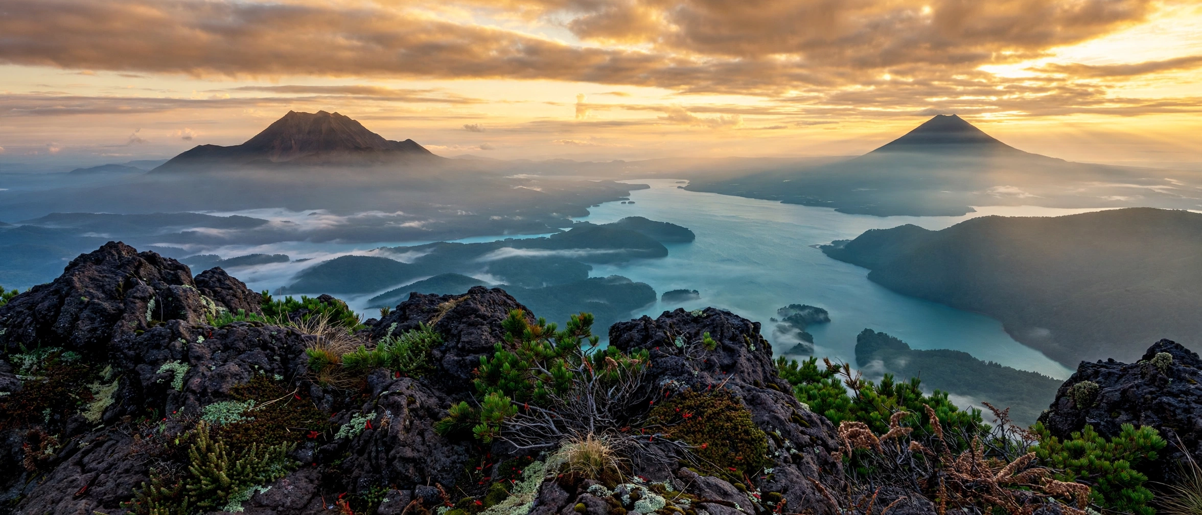
The Mount Oakan hike is the connoisseur's choice in the Akan caldera. It is the best place to stand and look down on all three caldera lakes at once: Akan, Panketo, and Penketo, the "twin lakes" hidden in the forest that few visitors ever see up close. Add the Ainu love story written into the mountain's name, a genuine volcanic history, and an onsen town waiting at the bottom, and you have one of Hokkaido's most complete day hikes.
Mount Oakan at a Glance
Before you commit to this climb, here are the numbers that matter, verified against the Japan Tourism Agency trail database and the Hokkaido mountaineering federation's course guide:
- Elevation: 1,370 m (4,495 ft) — official surveys list 1,370.2 m
- Location: Eastern rim of the Akan caldera, Kushiro City (Akan), eastern Hokkaido
- Park: Akan-Mashu National Park (the "Mashu" was added to the name in 2017)
- Type: Stratovolcano with a lava dome — andesite and dacite on the Kuril volcanic arc
- Route: One official out-and-back course from the Takiguchi trailhead
- Distance: About 11–13.4 km round trip, depending on the source
- Elevation gain: About 950 m (trailhead 420 m → summit 1,370 m)
- Time: 6–7 hours round trip for a fit hiker
- Difficulty: Hard — rated 4/5 by hiking guides and 6/10 by HokkaidoWilds
- Season: Mid-May to October; winter ascents are expert-only
No permit is required to climb — which puts Oakan in the same easy-admin category as most Japanese day hikes (see our guide on whether you need a permit to hike in Japan). There is no entrance fee either. What the mountain demands instead is fitness, an early start, and respect for the weather.
Oakan vs. Meakan: Which Akan Volcano Should You Climb?
This is the question every Akan visitor asks, so let's settle it. Mount Meakan (雌阿寒岳, 1,499 m) is taller, more famous, listed among Japan's 100 Famous Mountains, and still visibly active — its fumaroles steam on the far side of the lake. In addition, it has three separate trail courses and, frankly, most of the foot traffic.
Oakan is the smaller, wilder brother — and in Ainu tradition, literally the husband of Meakan (more on that below). The Mount Oakan hike is, by every official account, significantly more difficult than any of Meakan's trails. It is longer, with nearly a thousand metres of climbing. It also has a genuinely steep, loose crux near the top. What you get in return is solitude and the twin-lake view that Meakan cannot offer.
The practical answer: first-timers and anyone short on time should climb Meakan (the Onneto course is the classic). Experienced hikers with a full free day should climb Oakan — or better, do both across two days (see the itinerary at the end of this guide). If you are building a wider Hokkaido hiking trip, our Mount Niseko Annupuri guide covers another very different Hokkaido volcano. It pairs well into the same journey.
When to Hike: Best Months, Autumn Color, and the Fog Problem
The official hiking season runs from mid-May to October. Within that window, each stretch of summer has a distinct personality — and one shared enemy.
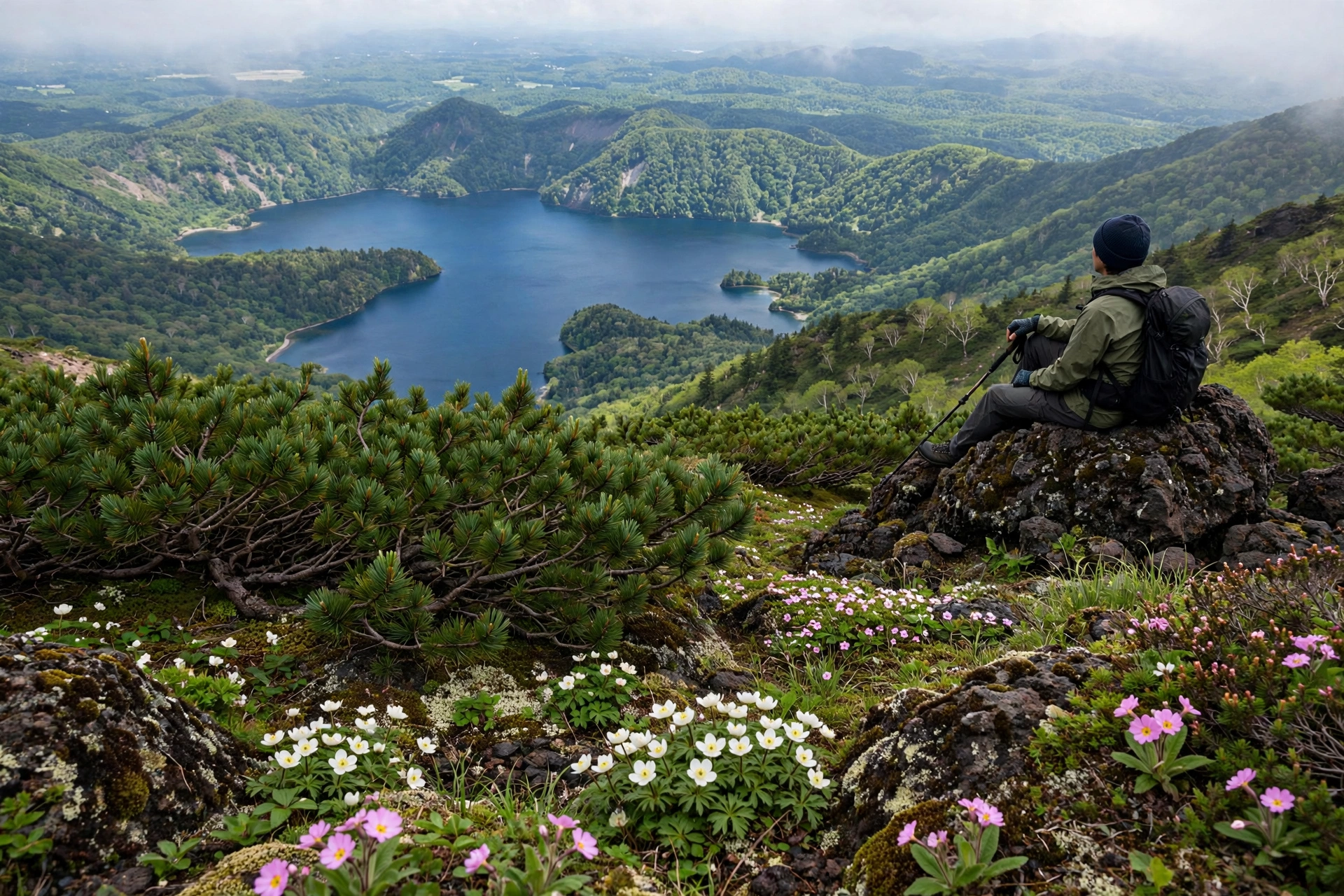
Late May to June opens the season. The trail is usually snow-free by late June, but patches can linger near the summit and freeze hard at dawn, so an early-June start can feel surprisingly wintery up top. The upside is real: Canadian dwarf cornel blooms white through the forest floor in June and July.
July and August bring the green season — alpine flowers at their peak, buzzards wheeling over the summit rocks, long daylight. They also bring the fog. The Akan region is famously fog-prone, and Oakan's summit spends a remarkable amount of summer inside cloud. This is the single biggest trip-ruining factor on this mountain. It is also under-covered in almost every English guide. So: start early, and build a spare day into your plans so you can pick the clearer morning.
Mid-September to early October is the sweet spot — and the best time for the Mount Oakan hike overall. Autumn color (katsura and Japanese rowan turning gold and crimson) starts around mid-September, the air clears, and you get the year's most reliable big-sky days. Trip reports note ice already coating the summit rocks by mid-October, so treat the second half of October as the season's graceful exit.
November to May is winter: deep snow, no marked route, and conditions for experienced winter mountaineers only. Do not attempt a winter ascent without full winter gear, navigation skills, and avalanche awareness.
Getting to the Takiguchi Trailhead
The trailhead is Takiguchi (滝口). It sits at roughly 420 m, the same altitude as the lake surface, and has public toilets. However, there is no drinking water.
By car (the easy way): drive Route 240 east from Akankohan (towards Kushiro) for about 5 minutes. Parking is small, so on autumn foliage weekends, arrive early.
By public transport (the committed way), take the Akan Bus between JR Kushiro Station and Lake Akan (roughly 2 hours) and get off at the Takiguchi stop, right beside the trailhead. From the Akankohan bus terminal it is only about 10 minutes. Buses are infrequent, so note the return times before you set off; if you miss the last one, you will need a taxi from Akankohan. From further afield, both Kushiro Airport and Memanbetsu Airport connect onward to the Lake Akan area by bus or rental car.
One honest planning note: bus services around eastern Hokkaido are thin and seasonal. Confirm the current Akan Bus timetable for your exact travel dates before you lock in a public-transport plan — a missed connection here can cost you the whole hiking day.
The Trail, Step by Step: From the Floodgates to the Summit
There is exactly one official course on Oakan, and it is an out-and-back: the same trail up and down. That simplicity is deceptive. In practice, the Mount Oakan hike packs three very different landscapes into its 6–7 hours. Here's how the day unfolds.
Leg 1: Trailhead to Lake Jiro (40 Minutes Return)
The route starts flat along the lakeshore floodgates, passing Lake Taro and reaching Lake Jiro through quiet forest. Official sources promote this stretch as a standalone walk, and it genuinely works as one (details in the next section). For summit-bound hikers, it's the warm-up.
Leg 2: The Forest Climb to the 5th Station
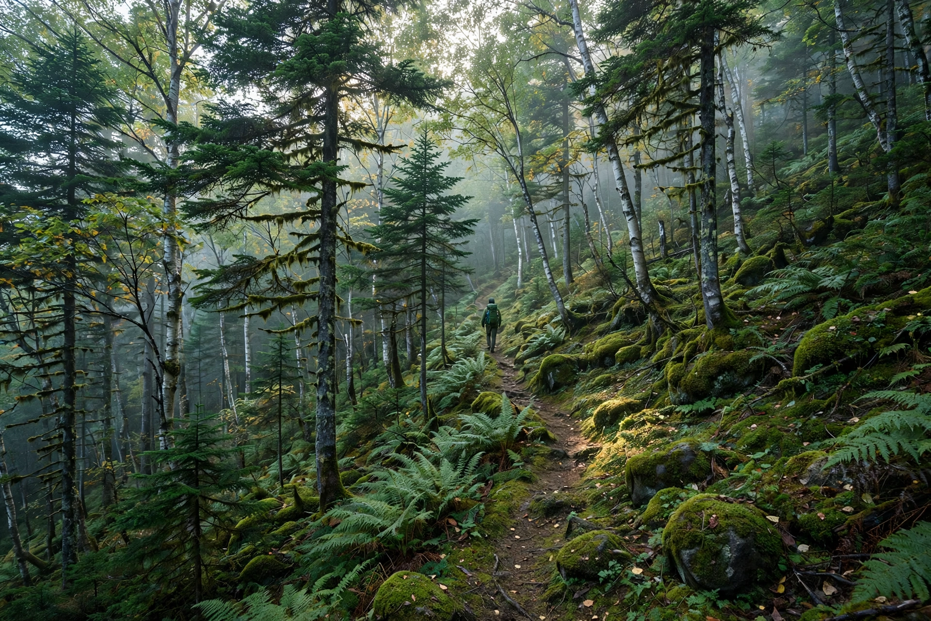
Past Lake Jiro the trail turns upward and doesn't really relent. You climb through distinct vegetation belts. First come Ezo and Aka-Ezo spruce and Sakhalin fir mixed with Mizunara oak. Then Erman's birch. The last stretch below the marker is the steepest, loosest climbing of the day. The 5th station marker sits at 1,194 m. In other words, about 775 of the day's 950 metres of climbing are done in the forest before the views even begin. This is the crux of the day: long, shaded, and steepest just below the marker.
Leg 3: The Ridge and the Crater Rim (1–1.5 Hours to the Summit)
Above the 5th station the hardest work is behind you. The forest gives way to a ridge through tunnels of haimatsu (dwarf stone pine) you half-crouch through, on comparatively gentle ground. Then, almost suddenly, you're on the crater rim — past an overgrown old crater, across undulating ground, to the rocky summit marker at 1,370 m.
Allow roughly 3–3.5 hours up and 2.5–3 hours down. And remember: there is no water on the route and no hut at the top, so everything you drink comes up with you from Takiguchi.
Lake Taro and Lake Jiro: The 40-Minute Warm-Up Walk
Don't sleep on the first kilometre of this trail. Lakes Taro and Jiro are two small, glassy lakes tucked into the forest just above the trailhead. The flat walk between them is one of the prettiest easy strolls in the Akan area. Expect trout visibly patrolling the clear water, dragonflies in summer, and utter quiet.
There's a lovely piece of hydrology hiding here, too. Lake Taro is fed by Lake Akan's outflow, released through the Takiguchi floodgates. From there it drains onward via the Akan River all the way to Kushiro. And the names? In old Japanese naming, Taro means "first son" and Jiro "second son" — the lakes are the mountain's children, in a sense. If anyone in your group isn't up for the full summit climb, send them on this 40-minute return walk while you climb; they'll still get a genuine Akan forest experience.
The Crux Below the Fifth Station
Every mountain has a section that separates a pleasant walk from a real climb, and on Oakan it's the steep slope just below the 5th station. The trail steepens sharply on loose volcanic sand and gravel where every step slides half a step back. Therefore, trekking poles earn their weight here, and downhill — when tired legs meet scree — is honestly the trickier direction.
Two more things to know about the upper mountain. First, near the 5th station you'll pass a junction with the abandoned Okurushupe Trail — an old, unmaintained route that still looks temptingly trail-like. Do not take it. Stay on the marked main course; the Okurushupe is unmaintained and an easy wrong turn for a tired hiker. Second, look for the stone ruins of an Imperial Japanese Army weather observatory. You'll find them about twenty minutes below the summit, near the 8th station. They are a strange, evocative relic of the 1930s–40s, sitting quietly in the volcanic rubble. Almost no English guide mentions it; now you know to look. This steep, loose section is a big part of why Oakan carries its "hard" rating despite the modest elevation.
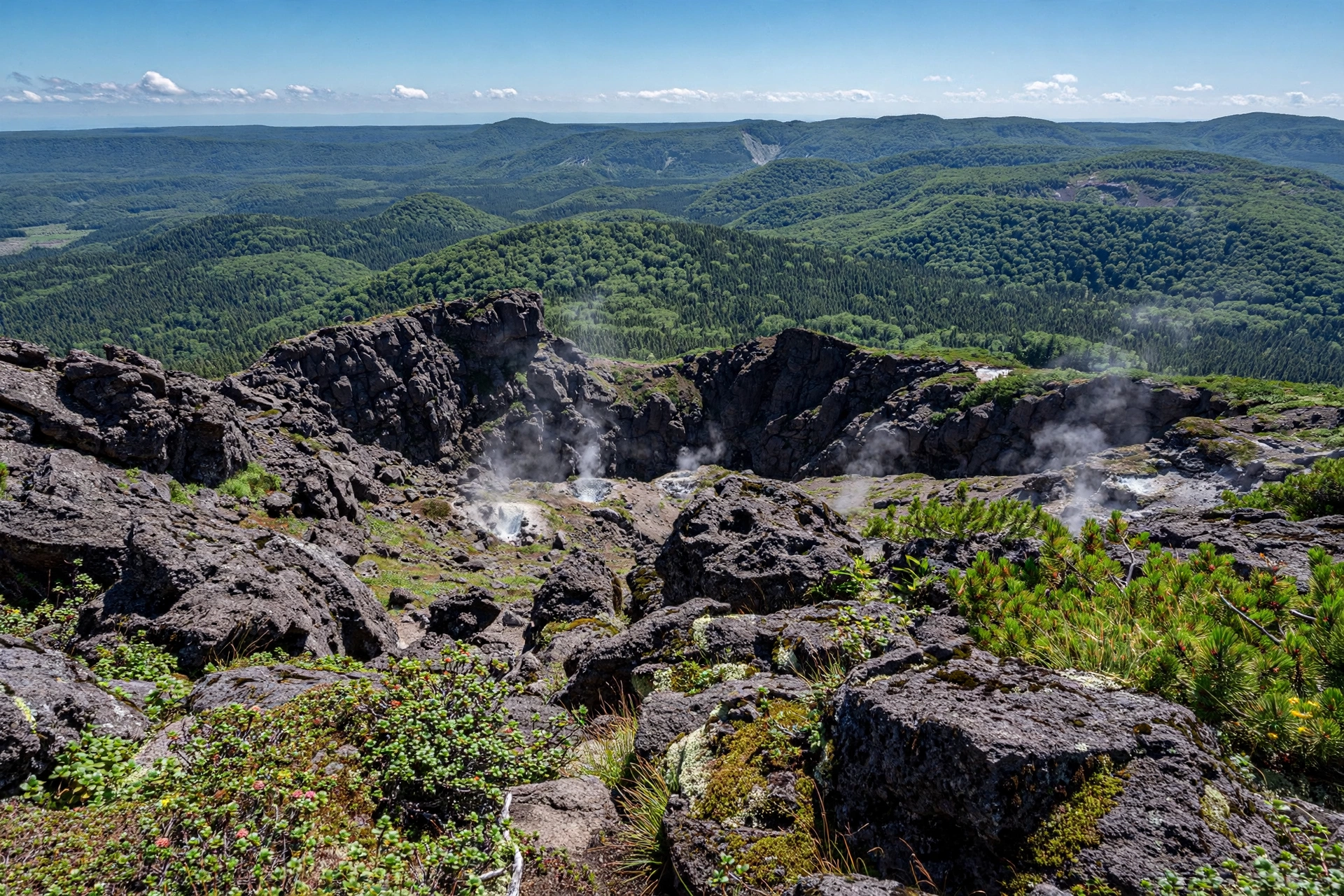
From the Summit: Twin Lakes, Meakan, and the Clear-Day Bonus
The summit itself is a rocky, open crown with a marker, the remains of three explosion craters on the summit cone, and — on the right day — one of Hokkaido's great panoramas. Directly below lie Lakes Panketo and Penketo, the twin lakes. They are forest-ringed and roadless, and otherwise seen only from afar at the Sokodai roadside lookout. This is the view that justifies the whole Mount Oakan hike.
Beyond them, the Akan cast assembles: Lake Akan itself, Mt. Meakan steaming faintly to the southwest, the perfect cone of Akan-Fuji, and Fuppushi-dake. On the clearest days, though — the kind late September and early October deliver — the horizon opens dramatically. To the northeast lies Lake Kussharo. Beyond it: Mt. Shari and the serrated Shiretoko range (the wild peninsula our Mount Rausu and Shiretoko traverse guide covers). Far to the northwest: the great Daisetsuzan volcanic group (see our Daisetsuzan lesser-trails guide). Bring a map and play peak-bingo; bring a wind shell, because the summit is exposed and the wind rarely takes the day off.
Fire and Myth: Oakan's Volcanic Past and the Ainu "Male Mountain"
Here's a correction worth making, because even some published sources get it wrong: Mount Oakan has no historically recorded eruptions. You'll occasionally see "last eruption: 2008" attached to Oakan in databases — that was actually Meakan-dake's Ponmachineshiri crater, erupting phreatically on November 18 and 28, 2008. Oakan's own summit crater formed thousands of years ago, and its only current sign of life is a weak fumarole at Kitanakahara, about 800 m up the flank.
The Eruption That Split One Lake Into Three
Oakan's ancient eruptions did something extraordinary. They split one enormous caldera lake into the three lakes we see today — Akan, Panketo, and Penketo. The mountain forms the eastern rim of the Akan caldera, a 13 × 24 km collapse structure holding four post-caldera stratovolcanoes.
Standing on the summit, you're standing on the rim of one of Japan's great calderas. Our Mount Aso crater-rim guide tells the same story from Kyushu's even larger caldera. It also echoes in the steaming craters of Kusatsu-Shirane and Mount Asama.
Pinneshiri: The Ainu "Male Mountain"
"Pinneshiri" — the Ainu name for Oakan — means "male mountain." In Ainu belief, Oakan is the husband of Meakan (Matneshiri, the "female mountain") across the lake. The Japanese names carry the same pairing: 雄阿寒岳 (male) against 雌阿寒岳 (female). The pairing is about shape, not size: Oakan rises as a single clean cone, while Meakan has two distinct peaks.
Hokkaido's volcanoes are rich in Ainu names and stories (see also our Mount Yotei guide), and this one gives the Mount Oakan hike a cultural thread most volcano climbs lack. You're not just climbing a stratovolcano; you're visiting the husband mountain in one of the Ainu world's great landscape marriages.
Bears, Deer Trails, and Mountain Safety
This is higuma country — Hokkaido brown bear territory — and the safety rules here are non-negotiable. Carry a bear bell and keep it ringing, hike in a group wherever possible, avoid dawn and dusk starts, stay on the marked trail, and never leave food waste behind. Before your hike, check the latest bear-sighting notices posted around Akankohan; sightings near the trailhead are reported most years.
Beyond bears, this trail has a subtler hazard: deer trails. Sika deer crisscross the forest with paths that look convincingly like the hiking route, and tired hikers have followed them astray. If the "trail" suddenly narrows, drops its markers, or feels wrong, stop immediately. Backtrack to the last marker and re-find the official route. This is also how people end up on the abandoned Okurushupe branch. Add the usual Hokkaido mountain sense: the Akan fog can erase visibility in minutes, so carry a map and know your turnaround time before you start. For a sense of how seriously northern Japan's mountains demand respect for weather and wildlife, our Hakkoda Mountains guide makes a useful companion read.
What to Pack for the Mount Oakan Hike
Oakan is a carry-everything mountain: no huts, no water, no shops from trailhead to summit.
- Footwear: Proper hiking boots with grip. The crux's loose gravel punishes trail runners and sneakers.
- Layers + rain shell: Summit wind is a given; Akan's weather turns fast. A warm mid-layer even in August.
- Water — 2 litres minimum: There is no drinking water at the trailhead or anywhere on the route. This is the single most-forgotten item.
- Lunch and snacks: Six to seven hours with 950 m of climbing burns real calories.
- Bear bell: Non-negotiable in higuma country. Bear spray is a sensible extra.
- Sun protection: Hat, sunscreen, sunglasses — the open upper mountain has no shade.
- Map: Paper or offline digital. Fog plus deer trails is a bad combination without one.
- Cash: For the onsen and any lakeside shops afterwards — small vendors around Akankohan can be cash-only.
- Trekking poles: Strongly recommended for the scree crux, especially on the descent.
- Headlamp: Even on a day hike; a 6–7 hour route leaves little margin if you're delayed.
After the Hike: Onsen and Marimo at Akankohan
Five kilometres west of the trailhead sits Akankohan, on Lake Akan's southern shore. It is one of Hokkaido's classic onsen towns — and the perfect end to a Mount Oakan hike day. Soak out the 950 metres in a lakeside bath, then walk the evening streets: the town runs on a lovely rhythm of hot spring steam, souvenir shops, and Ainu craft.
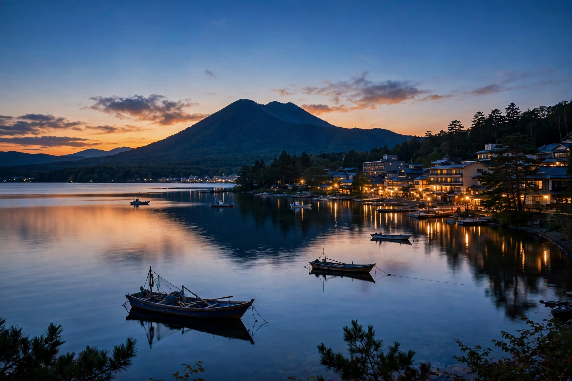
Don't miss the lake's most famous resident: the marimo. These spherical green algae grow here to 30 cm across — the largest in the world. They are protected as a Special Natural Monument of Japan. The Ainu call them torasanbe, "spirit of the lake". They were scientifically described in 1897. Today you can see them on the 85-minute sightseeing cruise to the Marimo Exhibition and Observation Center on Churui Island. Time your trip for around October 8–10 and you'll catch the Marimo Festival, held since 1950 and led by the local Ainu community — a beautiful pairing with an early-October autumn hike. Afterwards, look for the bokke bubbling mud pools near the lakeshore, and keep an eye on the water: Lake Akan holds Sakhalin taimen and kokanee salmon.
Two-Day Plan: Pairing Oakan with Meakan and Akan-Fuji
If you've come all the way to eastern Hokkaido, one volcano is a shame. Here's the two-day pairing that gets you the full Akan caldera:
Day 1 — Mount Oakan. Start early from Akankohan (beat the fog), hike the Takiguchi course, summit by midday, back down by mid-afternoon. Evening: onsen, marimo cruise or lakeside walk, early night.
Day 2 — Mount Meakan + Akan-Fuji. Drive to the Onneto trailhead on Meakan's quieter side. Climb Meakan (1,499 m) via its active crater zone. It is a completely different volcanic experience — all fumaroles and sulfur. Then traverse to the perfect cone of Akan-Fuji (1,476 m), which links to Meakan's summit in 1.5–2.5 hours return. Note there is no ridge traverse between Oakan and Meakan — the lake sits between them — so this is a two-trailhead plan, not a through-hike. Together, the two days give you the husband mountain, the wife mountain, and their conical neighbour: the whole Akan family in 48 hours.
Mount Oakan Hike FAQ
How long does the Mount Oakan hike take?
Plan for 6–7 hours round trip. That breaks down as roughly 3–3.5 hours up and 2.5–3 hours down, including short breaks. Fast hikers on a clear day can do it in about 5.5 hours; there's no prize for rushing the crux.
How difficult is Mount Oakan?
Hard. It's rated 4/5 by hiking guides and 6/10 by HokkaidoWilds, and official sources call it significantly more difficult than Mt. Meakan's trails. The 950 m elevation gain, the loose-gravel crux below the 5th station, and the full-day length demand solid fitness and hiking experience.
Can beginners hike Mount Oakan?
The full summit is not a beginner hike. Beginners can enjoy the flat 40-minute return walk to Lake Jiro from the same trailhead, or climb Mt. Meakan's Onneto course instead — and save Oakan for their second Hokkaido trip.
Is there really only one trail?
Yes — one official out-and-back course from Takiguchi. Near the 5th station you'll see a junction with the abandoned Okurushupe Trail; it is unmaintained and should not be taken.
When is the autumn foliage at its best?
Color typically starts around mid-September (katsura and Japanese rowan), with the clearest summit views of the year through early October. By mid-October, ice can already coat the summit rocks.
Are there bears on Mount Oakan?
Yes — Hokkaido brown bears (higuma) live in these forests. Carry a bear bell, hike in a group, avoid dawn and dusk, stay on the trail, and check local sighting notices at Akankohan before you go.

1 thought on “Mount Oakan Hike: Hokkaido’s Twin-Lake Volcano Guide”