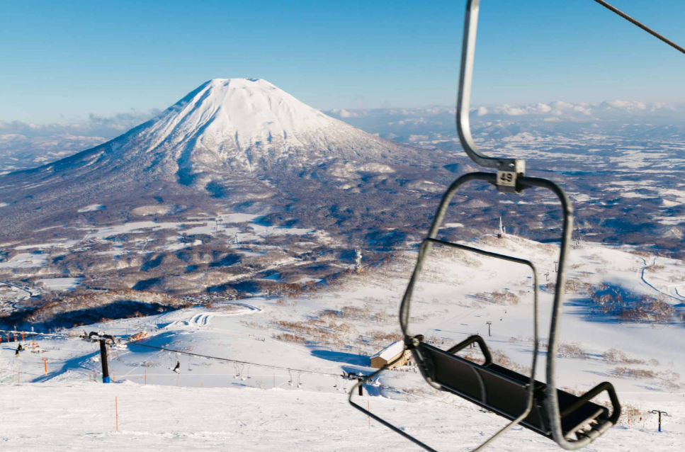
In Hokkaido, within Niseko-Shakotan-Otaru Kaigan Quasi-National Park. The 1,308m high Mount Niseko Annupuri is a well-known volcano that produces powder snow. This mountain is a world-class skiing spot. Mount Niseko Annupuri hike is gaining popularity among visitors who prefer to visit this iconic peak without snow.
For hikers interested in exploring another scenic mountain in Japan, the Mount Oyama hike offers a different experience.
🥾 Mount Niseko Annupuri Day Hike: Quick Summary
Everything from the guide below, condensed — plus a few things most guides skip.
📊 Hike Summary
Distance
~5.5 km round trip
Elevation gain
~560 m (summit 1,308 m)
Time
~3–3.5 hrs on foot, ~1.5 hrs via gondola
Difficulty
Moderate🚌 Getting There
By car, the Goshiki Onsen trailhead is about 30 minutes from the Kutchan IC on the Shiribeshi Expressway. On public transport, take the Niseko Bus from JR Niseko Station to Goshiki Onsen — about 65 minutes, running roughly April–November.
- The Niseko Bus (Niseko Line) runs mainly on weekends and holidays in summer — check the timetable before relying on it.
- Parking, toilets and the trailhead are right at Goshiki Onsen, next to the bus stop.
- Taxis from Niseko or Kutchan Station are a reliable backup on days the bus doesn’t run.
- The summer gondola leaves from the ski-resort side (top station ~1,000 m) — separate from the Goshiki trailhead, and it only operates roughly mid-July to mid-October.
🧭 Choose Your Trail
Goshiki Onsen Course
The classic route: well-marked single track, marsh and grassland below, open volcano slope above. About 1 hr 50 min up.
Ski-Resort Course
From the summer gondola top at ~1,000 m — just 1.3 km to the summit, about 1 hr 10 min. The shortest way up.
Grand Hirafu Course
Long ridge route from the Hirafu side at 820 m, about 3.5 hrs up. Big views, more elevation, fewer facilities.
Trails can be closed or wrapped in mist on short notice, and the exposed summit is windy — check conditions before committing to a route. A popular pattern: ride the gondola up to shorten the climb, then hike back down the ski-resort trail; or do the full Goshiki Onsen route for the classic experience. It’s brown-bear country, so stay on the trail and make noise.
📅 When to Hike
🌤️ Weather Check
🎒 What to Pack
💡 Good to Know Before You Go
Elevation
1,308 m
Location
Kutchan & Niseko Town, Hokkaido
Belongs to
Niseko-Shakotan-Otaru Kaigan Quasi-National ParkTable of Contents
A Mountain With Two Very Different Seasons
While much is said about this area during the winter, a more relaxed and verdant side shines out every summer. Snowboarders are transported by ski lifts in January. Further, the lifts are used in the summer to transport skiers. In summer, hiking trails are opened throughout the slopes, typically packed full of snow in the winter. This difference makes a Mount Niseko Annupuri hike a once-in-a-lifetime opportunity to discover skiing.
Its origin is volcanic, along with some of the other peaks in the vicinity. There is an unofficial nickname for Mount Yotei, "Ezo Fuji", or Japan's Fuji, for its similar symmetry. One of the best views of this neighbouring volcano is from climbing Annupuri.
When to Plan this Hike?
Most of the time, hiking Mount Niseko Annupuri is advised from June to October when the majority of the higher trails have been snow-cleared. Fresh alpine growth and wildflowers abound in early summer and continue through July. August weather is warm and stable, so it's a nice time to visit.
September and early October are frequently touted as having cool air. Further, starting to see the fall colour in the surrounding hills. An early-morning start is usually recommended. Often, it is noted that clouds are thickening around the summit early in the afternoon.

Step 1: Decide to Use
During the summer, a gondola is used on the lower part of the mountain and can be used to significantly cut the length of a hike to Mount Niseko Annupuri. This is a great choice for people with only a short amount of time to spend or those who don't want to spend as much effort on the upper sections of the trail.
It is proposed to use the gondola in the initial ascent, so that the route to be walked should start at a higher elevation. This is a favourite of families and first-time visitors to the mountain.
Step 2: Choose a Trail Route
There are many different routes up the mountain, and which one to take will depend on time, fitness and origin.
Gondola Route: This is the easiest route, starting from the top gondola station. The trail here leads to the top of a moderate level, which is ideal for a first hike of Mount Niseko Annupuri.
Base Village Route: This is a longer route that starts right from the village area at the base of the mountain. Much more climbing is needed, and this tends to be the one selected by those who are looking to take in more of a workout.
Ridge Connection Route: If you wish to continue your journey, there is a ridge track that is linked to other peaks in the Niseko area. This requires more exertion and is for seasoned hikers.
Regardless of the route chosen, the current status of the trail should be checked before going because, in some cases, it is closed after heavy rain.
Step 3: Make Preparations for the Body
The length of the route depends on the level of fitness required, and for the gondola-assisted route, a moderate fitness level is usually enough. Walking or light cardio is recommended the week prior to departure. Building leg strength is also important with simple exercises, and loose volcanic soil and uneven terrain are found throughout much of the upper mountain.
A shorter practice hike is also recommended to test the shoes to be worn in advance. Balance should be practised on uneven surfaces, as this is particularly significant towards the top of Mount Niseko Annupuri on a hike.
Step 4: Packing the Right Gear
Comfort and safety are of major concern: A well-prepared kit. These are normally suggested:
- Stable and well-fitting hiking boots.
- Clothing is layered, as changes in temperature are apparent with different elevations,
- A jacket that is waterproof and windproof (due to the unpredictable weather in Hokkaido)
- Useful when hiking on loose volcanic terrain: trekking poles.
- Sunscreen and a hat – as exposure rises with elevation above the tree line.
- Adequate water and trail food
- A first aid box or kit.
- A trail map (because the signal is not always reliable at its peak)
Step 5: Where is the Beginning of the Ascent?
Starting from the upper gondola station, there is a moderate path through low alpine vegetation. In the winter, ski runs can be seen nearby, providing an unexpected sight of the mountain's snow-covered side. This is a typical "easiest" section to start before the approach opens up to a steeper slope. The route from the base to Mount Niseko Annupuri is generally more challenging than the one from the summit. The course is loose, so the trip from the summit is more difficult.
Step 6: The Alpine Meadows
This trail is found on numerous sections of wildflower meadows, especially in early and mid-summer. This is a popular stopping point as this is one of the most colourful of the highlights of the hike at Mount Niseko Annupuri. This section is often done at a slower speed, so as to enjoy the scenery.
Step 7: Making the Approach to the Summit
The route gets harder on the rocks as it ascends higher, and the last stretch up to the top is a long, hard one. Here, the wind exposure is more marked and a slow and steady pace is advised. This is the last part of the Mount Niseko Annupuri hike, which is the most physically demanding in the entire trek.
Sweeping views will be provided upon reaching the top, where you will be able to see the surrounding Niseko range. On clear days, Mount Yotei can be seen, standing high and symmetrically shaped, above the valley. Under favourable conditions, sightings of the Sea of Japan have been reported from afar.
Step 8: The Descent
A slow and steady descent should be used for descent, especially on the loose volcanic gravel found at the summit. Use of trekking poles should be maintained, as it will help to save weary knees on the rough terrain.
The route is normally suggested to be retaken towards the gondola station, from which a return ride can be made to finish the descent more quickly.
Safety Guidelines
A few precautions are recommended for a flawless Niseko Annupuri hike:
- Care needs to be taken with weather forecasts because the conditions in Hokkaido may change quickly.
- Exposure to the wind is to be expected, especially along the summit ridge.
- Please schedule gondola times in advance.
- Adequate water is to be carried, even on short gondola-assisted runs.
- Clothing should always be packed in layers, whether in summer or winter.
- Don't separate when hiking, especially on the upper exposed areas.
The following are general suggestions recommended by local park authorities, and it is believed that they are important for a safe and pleasant outing on this volcanic peak.
How We Would Choose Our Annupuri Route
| Trail | Stats in this guide | We would choose it if you… |
|---|---|---|
| Ski-resort course from the gondola top | About 1.3 km to the summit, around 1 hour 10 minutes, easy | want the shortest way up, or are hiking with children |
| Goshiki Onsen course | Moderate, about 1 hour 50 minutes up, with signs every 500 m | want the classic route through marsh and open volcano slope |
| Grand Hirafu course | Hard, about 3.5 hours up from 820 m | want a long ridge day and fewer facilities |
The summer gondola only runs roughly mid-July to mid-October, so our default would be the Goshiki Onsen course and a gondola ride only if it is operating. The Niseko Bus to Goshiki Onsen runs mainly on summer weekends and holidays, so we would keep a taxi in mind as a backup, and we would start early because the guide notes cloud thickens around the summit in the afternoon. It is brown-bear country, so we would carry a bell, stay on the trail and avoid dawn and dusk.
From the summit, this guide says you may see Mount Yotei on a clear day, which is worth planning around: see our Mount Yotei guide for the climb itself.
A Ridge of Mountains that Merit a Visit
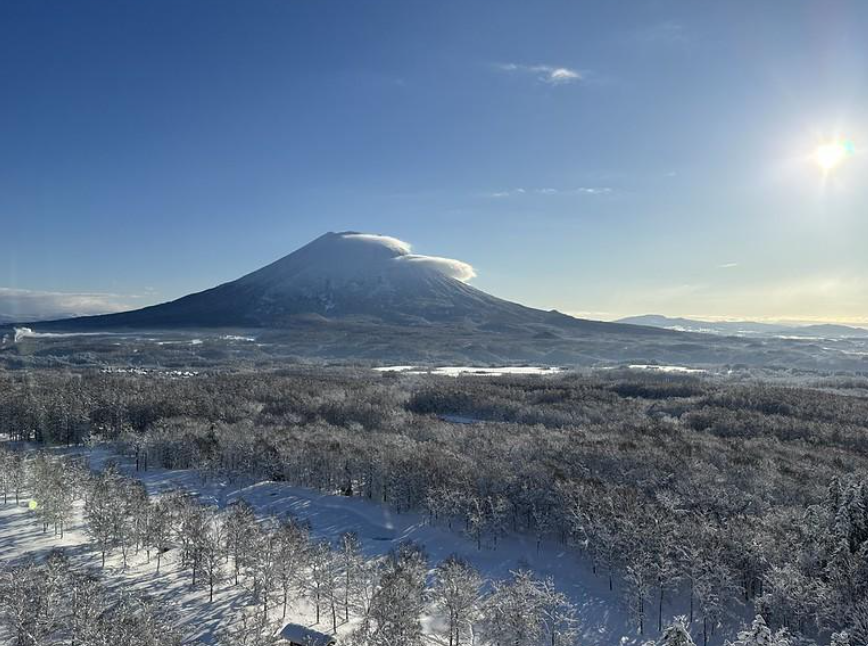
The hike to Niseko Annupuri is especially interesting because it allows you to have a taste of a world-famous skiing area in a new light. Here you find no snow, but wildflowers, volcanic terrain, and sweeping vistas towards Mount Yotei.
This mountain offers a moderate yet rewarding climb, offering a fresh perspective on one of Hokkaido's most renowned landscapes; the mountain's appeal is far beyond the winter season.

1 thought on “Mount Niseko Annupuri: Hokkaido’s Summer Side of a Winter Legend”