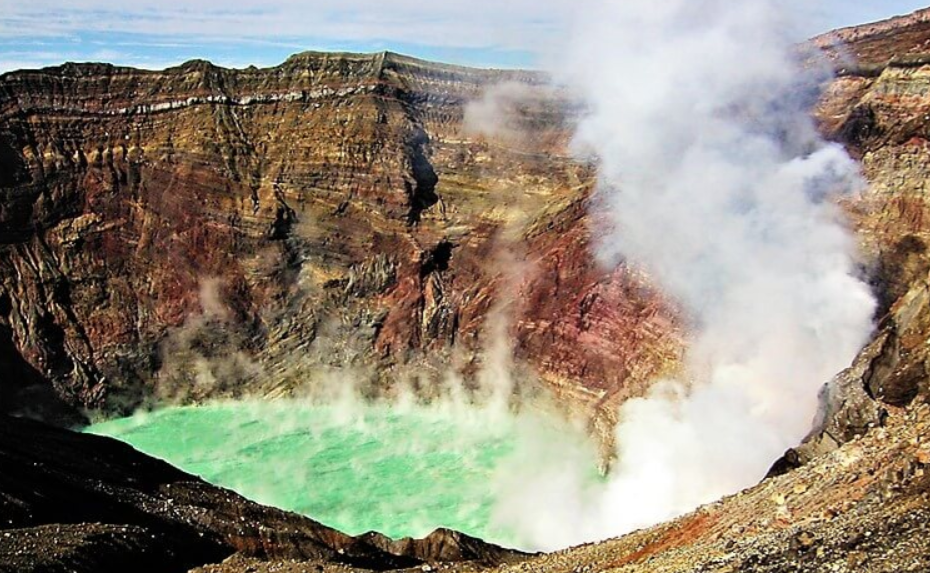
Being at the edge of an active volcanic crater is one of the most thrilling experiences Japan has to offer. Mount Aso (Aso-san) lies in the centre of Kyushu in the Japanese prefecture of Kumamoto and is one of the largest calderas on Earth, with a central group of active volcanic cones, dark ash and turquoise water. It is important to be well prepared to handle this quickly changing environment. MOUNT ASO CRATER RIM HIKING requires flexible planning that adapts to the evolving situation caused by volcanic gases and high-altitude weather conditions.
Table of Contents
Anatomy of the Aso Caldera
It is not a single mountain, but a huge volcanic complex within a massive caldera 128 kilometres around the mountain for MOUNT ASO CRATER RIM HIKING. In this old basin are the Aso Gozan (Five Peaks of Aso).
1. Nakadake (1,506m)
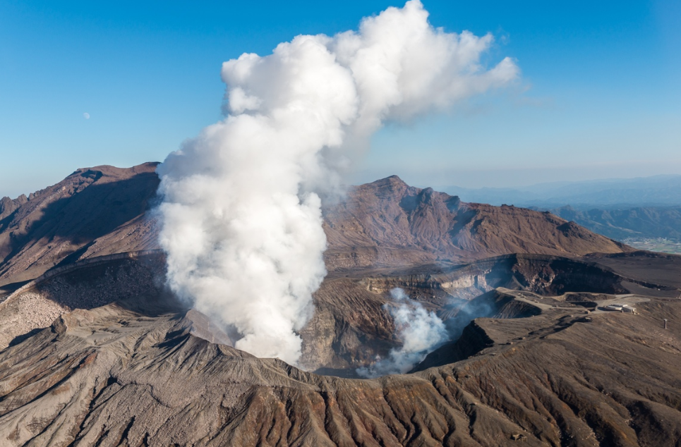
2. Takadake (1,592m)
The peak of the main volcanic range. The summit of Takadake is reached from the edge of the crater by taking the “ridge road” that goes around the outer caldera, offering a 360-degree view of the entire outer wall of the caldera.
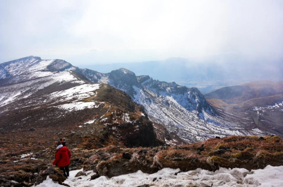
3. Eboshidake (1,337m)
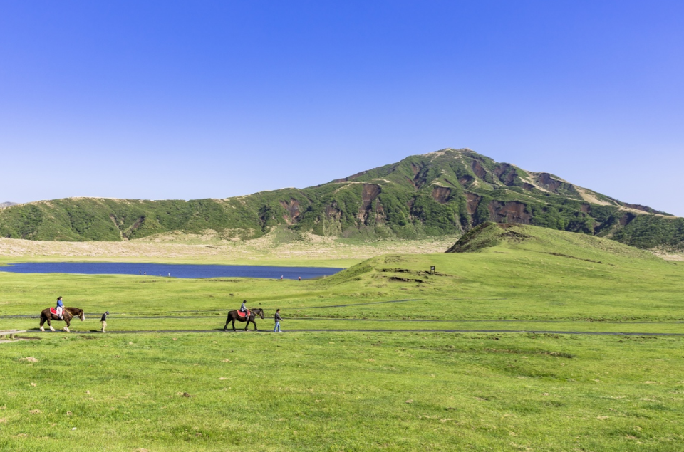
This peak provides gentle ascents of the famous emerald pastures of Kusasenri-ga-hama and impressive vistas, all the way round the peak, of the billowing steam column of Nakadake.
A Couple of Options
- Sunasenri to Takadake Loop: A total distance of 7.5 km with a duration of about 4 hours and 520 m of elevation gain. The route follows dark ash plains and steep volcanic ridges to see active vents up close.
- Kusasenri & Eboshidake Circuit: A more relaxed 4.2 km hike that will take approximately 2 hours and includes 210 m of ascent. It is a route that passes through ancient grassy crater lakes and provides easy, broad access to the primary steam column.
- Sensuikyo Ridge Approach: 6.0 km with 700 m of ascent and a duration of 4.5 hours, making it a challenging approach. This is a hike up the northern ridge to Takadake, requiring a good degree of scrambling over raw lava rock.
Step-by-step guide
Safety and planning are essential when hiking through an active volcanic area.
Phase 1: How do volcanic activity and gas levels differ?
Please consult the official volcanic alert level from JMA (Japan Meteorological Agency) in the morning. Generally, access to the Nakadake crater rim is allowed at Alert Level 1. At Level 2 or above, it is not possible to enter within 1–2 km of the crater. Please check these regulations in the early stages of MOUNT ASO CRATER RIM HIKING.
Phase 2: Ensure transport to Central Trailheads
From JR Aso Station, take the JR Hohi Main Line train. Then, go from there to Asosan Terminal or Kusasenri-ga-hama on the local Sanko Bus, which takes around 35 minutes. For those who are driving a rental car, head up Route 111 (Panorama Line) to the upper parking lot.
Phase 3: Prepare for Volcanic Hazards
The volcanic area is rugged and bare. Wear high-top hiking boots with thick soles to protect your feet from sharp lava rock and scree. Bring eye protection to protect against airborne ash, and wear a wet cloth or a mask over your face if sulfur dioxide (SO₂) gas may be present.
Phase 4: Travel through Sunasenri Cinder Fields
Start on the trail from Sunasenri, a wooden boardwalk over rugged black volcanic terrain. Be sure to carefully follow the wooden posts and the yellow marker stones. Watch for the concrete evacuation shelters that are set up along the way—they serve as quick shelters in case of an unexpected gas spike or emission.
Phase 5: Finish the Ridge Traverse to Takadake
Hike up the rocky gully, up to and across the rim of the crater. Use the small footpath that joins Nakadake and Takadake, and be aware of your surroundings. If warning sirens sound or gas detectors flash red at any time, change course and head down to lower ground according to the safety guidelines of MOUNT ASO CRATER RIM HIKING.
Seasonal Hiking Windows
- Spring (April–May)
Just cool enough to be at ease when walking on the ridges. In mid-to-late May, the lower slopes of Eboshidake and Sensuikyo are covered with deep pink alpine azaleas, also known as Miyama-kirishima azaleas.
- Summer (June–August)
There is lush greenery around the caldera pastures. It frequently rains or becomes very foggy in the mountains, so high-quality waterproof gear is a must.
- Fall (September–November)
For well-travelled trekkers, this is the “best” season of the year. Fall brings crisp air, superb views throughout the crater area and pleasant daytime temperatures.
- Winter (December to March)
Snow and ice are likely to accumulate on the higher ridges. Microspikes, thermal layering and winter trekking experience are recommended for MOUNT ASO CRATER RIM HIKING because of freezing temperatures and biting winds.
Spending time getting ready for an Unforgettable Trek
One of Kyushu’s best outdoor activities is hiking the rim of the active crater of Mt Aso. You can enjoy the immense power of volcanic Japan safely by checking the volcanic status before heading out, wearing the right equipment, staying alert on the trail and obeying the park rules. With MOUNT ASO CRATER RIM HIKING, you will have an unforgettable and well-prepared hike through this amazing terrain.
