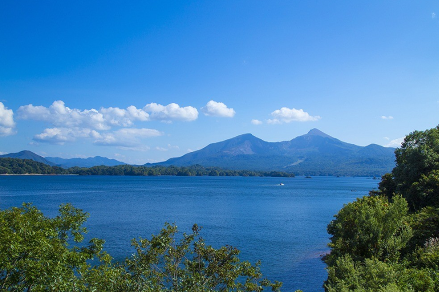
Mount Bandai is located in the heart of Fukushima Prefecture. It is so beautiful that it has become known as “Aizu Fuji. This volcano is 1,816 m high. It is well known for its spectacular volcanic eruptions. Moreover its benign image as one of Japan’s best family hikes. Mount Bandai hike is a hike that is followed by both beginners and advanced hikers. In large part, because there are a number of different routes catering to various levels of skill.
Table of Contents
A Mountain Altered by an Eruption
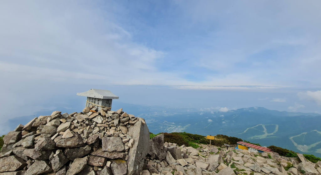
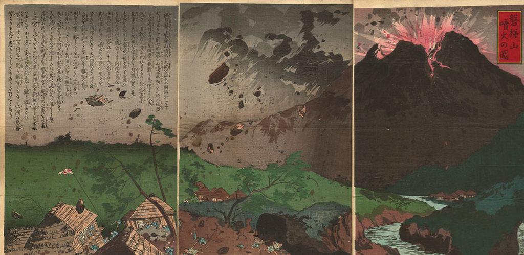
Much of Mount Bandai’s present shape is due to the huge eruption of 1888. Morover it0 broke away the northern face of the mountain. This event led to the formation of the rugged cliffs of the crater (which remain to this day). The chain of picturesque lakes that now forms the Bandai-kogen area. This history makes a hike up Mount Bandai an enjoyable experience of the beauty of the Japanese landscape. It is also a momentous geological event that can be seen.
As opposed to more distant peaks, Bandai is flanked by towns on the shores of the lakes. This is one of the reasons that the mountain is so popular amongst domestic tourists and hiking families.
Time to Climb
The season for hiking here is longer than on many of the alpine peaks. It typically runs from late April until early November. Typically, lower trails are cleared of snow first. However, the upper trails can have a few patches of snow until early summer. A mountain hike (trip on a mountain) will normally be the most comfortable. Further, the reliable period of time ranges from June through September.
Early Summer is when the greenery is abundant, and the weather isn’t as hot. There is a possibility of heat and humidity in lower elevations in midsummer, but it is much improved up higher. October and early November are considered to be the best months for the beautiful colour-changing leaves of the hillsides surrounding the area. It is always a good idea to leave early in the morning as it is likely to cloud upin, the afternoon near the summit.
Choosing a Starting Route
There are several trailheads, and various factors such as fitness, time and desired scenery should be used to make a decision.
Hachijogahara Route: It is the most popular route for a Mount Bandai hike. Access is from the north near Bandai-kogen, and the path is rated as well-graded and is good for beginners.
Ura-Bandai Route: This route also runs from the north, but is more near volcanic craters that were created during the eruption in 1888. Rock formations can be seen along the way, some of which are very dramatic and are of interest to geologists.
Okinajima Route: This route is approached from the South, and is usually considered a steeper and quieter route. This area is not as popular as other sections of the trail and is great for the more solitary hiker.
Regardless of the trails, it is important to be aware of current trail conditions and note that sometimes trails are closed during rainfall because of the conditions.
Getting Physically Ready
The beginning of the preparation should start well before the actual climb. The development of cardiovascular fitness is usually achieved by walking, jogging, or cycling for a few weeks prior to the trip. A focus on leg strength is also given, as most routes are on rocks and roots.
It is also recommended that a practice hike be done with the loaded pack to ensure proper boot and strap fitment. It is also recommended to stretch the calf and hip muscles for the entire stretch, since they are heavily utilised when going up and down on a Bandai hike.
Packing the Essentials
It’s essential for comfort and safety to have a well-equipped pack. Usually, they recommend the following items:
- Good hiking boots with an effective grip.
- Moisture-wicking layers, in conjunction with a light insulating layer,
- A waterproof jacket, as it can rain at any time in this area.
- Trekking poles that can be used both on the way up and down steep hills.
- A sun hat and sunscreen, especially for areas of the body that will be exposed to the sun on the ridges.
- A sufficient amount of water for several hours (with electrolyte tablets as necessary)
- Nuts, energy bars, and dried fruit are good types of trail snacks.
- A small First Aid Box
- A map of the trail (some of these trail junctions were not clearly marked in dense forest)
- Special consideration needs to be given to rain gear—these are the kinds of places where a day may be sunny and yet the weather quickly changes.
Making the Climb
The climb is broken down into a number of sections, each one different.
All trails enter the dense forest first from most of the trailheads. Cedar and beech trees are frequently found, and this trail is often overgrown and somewhat flat. It doesn’t take long to get used to the sound of birds, and in general this part is considered a nice warm-up to the more challenging sections ahead.
As you climb the trail, it becomes less forested and more and more evident that you’re walking on volcanic rock. Especially on the routes in the immediate vicinity of the crater, there can be seen close-up jagged formations which are the result of the collapse of 1888. Here the footing needs to be more closely considered, and trekking poles will be particularly beneficial.
Further up, open lines of ridges are located, and vistas start to open up greatly. In the vicinity of these lakes, which formed as a result of the historic eruption, one can sometimes see the glistening far below. This is one of the best sections of a hike up Bandai, as the size of the volcanic terrain becomes apparent.
The last stretch to the top is relatively gentle, but involves some loose rock climbing. It is recommended to proceed slowly and deliberately; if this isn’t done, fatigue may also be a cause for slips and falls.
Reaching the Top
From the summit, panoramic views are available virtually all around. South of the lake you can see Lake Inawashiro, and north of the lake the Bandai-kogen lake district. On these particularly clear days, ranges of mountains can be seen in the distance on the horizon.
Most of the time at the top is spent resting, eating and taking pictures, although it is recommended that visitors be vigilant about the changing weather. The clouds may quickly gain momentum, even starting with clear skies in the morning.
Read More: Check Out What Gear You Need to Climb Mount Fuji
Descending Safely
Descending a Mount Bandai hike is as much about care as climbing upwards. On flatter areas, it is likely that loose volcanic gravel will be found, and a slow, steady pace is advised for all areas. It is still good practice to use trekking poles; this will help to minimise knee stress.
In addition, it is recommended that hikers continue to use the trail during descent through the loose screen as it may lead to a greater risk of injury from falling. A headlamp is advised, and enough time should be given prior to the setting sun.
Ways to stay safe while playing
Many warnings are strongly recommended for those who are planning this climb:
- Be sure to check the weather forecast the night before and prior to the trip.
- The hiking itinerary should be left at a visitor centre or accommodation.
- Pack all rain gear no matter what the weather is like.
- Lots of water must be brought along as shaded refill point areas are sparse in the upper sections.
- Hikers are to stay within sight of each other on the trail.
- Periodic volcanic advisories should be checked, as the volcano is an active one under monitoring by Bandai.
The measures are generally recommended by the regional tourism authorities and, because of the volcanic nature of the mountain, are recognised as having significance.
A Landscape Born from a Disaster
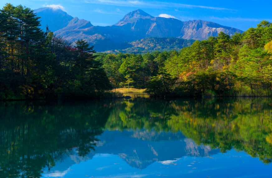
What makes a Mount Bandai hike so interesting is the contrast between destruction and renewal that one can see. It was the 1888 eruption that changed everything here, but decades later, it has evolved into one of the most valued natural wonders of Fukushima, where lakes, forests and wildflowers once again thrive on the once-barren slope.
This mountain is a rare chance to hike through the debris of a great volcanic eruption that is now part of Japan’s most picturesque hiking trail.
